
MANILA
Station summaryPTAG


| IGS-type acronym : | PTAG |
| Latitude : | 14.53544200 |
| Longitude : | 121.04076700 |
| Installed date : | 2008-09-23 |
| Decommissioned date : | |
| Country : | PHILIPPINES |
| City: | MANILA |
| Station status : | active (green) |
| Distance to Tide Gauge (m) : | 9568 |
| Domes Nr.: | 22006M005 |
| Station operator: | Unknown |
| IGS-like station form : |
GPS position times seriesPTAG
Position
(Reference epoch: )
(Reference epoch: )
Offsets (mm)
| M | Material change or malfunction |
| E | Earthquake |
| RF | Reference Frame change |
| U | Unknown |
| NA | Not available |
| Position discontinuity | |
| Velocity discontinuity |
Data available at SONELPTAG
Quality plots on RINEX filesPTAG
 |
 |
Plots generated using software developed with the EPN team at ROB |
| Observations & tracking performance | Satellite tracking |
 (this operation may take 20 to 45s)
The satellite tracking graph has been calculated for all stations for the first day of each month. If you wish to have a graph for another date, choose the 'Calculate a specific date' option.
Comparison with satellite altimetry data
- Link to Sea Level Differences (Satellite altimetry minus tide gauge data).
Co-located instrumentsPTAG
Leveling & DatumsPTAG
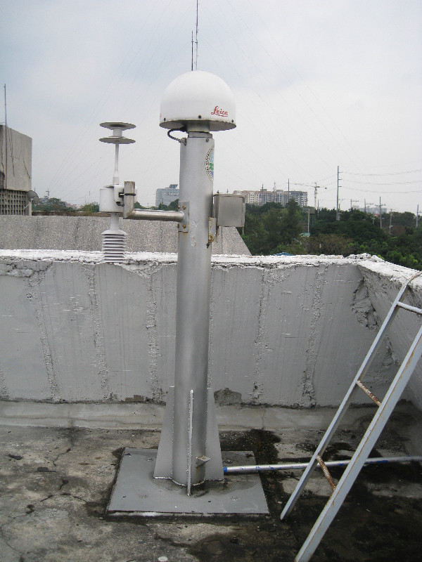
Photo albumPTAG
BibliographyPTAG
If you have a relevant reference to suggest, please send-us an e-mail : sonel@sonel.org-
 Raucoules, Le Cozannet et al., 2013. High nonlinear urban ground motion in Manila (Philippines) from 1993 to 2010 observed by DInSAR: Implications for sea-level measurement. Remote Sensing of Environment.


