
BREST
Contributing agency

Station summaryBRST


| IGS-type acronym : | BRST |
| Latitude : | 48.38049324 |
| Longitude : | -4.49659521 |
| Installed date : | 1998-10-31 |
| Decommissioned date : | |
| Country : | FRANCE |
| City: | BREST |
| Station status : | active (green) |
| Distance to Tide Gauge (m) : | 293 |
| Domes Nr.: | 10004M004 |
| Station operator: | Unknown |
| IGS-like station form : |
GPS position times seriesBRST
(Reference epoch: )
| M | Material change or malfunction |
| E | Earthquake |
| RF | Reference Frame change |
| U | Unknown |
| NA | Not available |
| Position discontinuity | |
| Velocity discontinuity |
Data available at SONELBRST
Quality plots on RINEX filesBRST
 |
 |
Plots generated using software developed with the EPN team at ROB |
| Observations & tracking performance | Satellite tracking |
 (this operation may take 20 to 45s)
The satellite tracking graph has been calculated for all stations for the first day of each month. If you wish to have a graph for another date, choose the 'Calculate a specific date' option.
Comparison with satellite altimetry data
- Link to Sea Level Differences (Satellite altimetry minus tide gauge data).
Co-located instrumentsBRST
- Tide gauge : BREST (BREST)
- GPS : Guipavas (GUIP)
- GPS : Bourg Blanc (BGBC)
- GPS : BREST Kervezennec (BRES)
Leveling & DatumsBRST
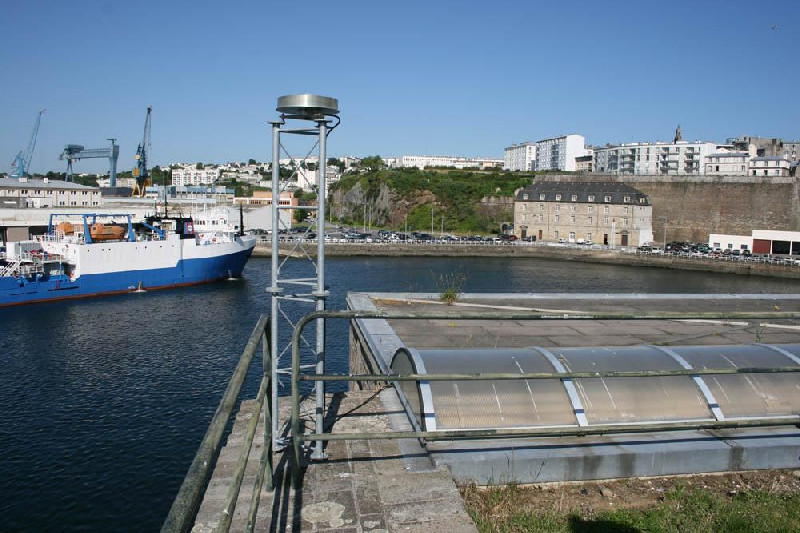
Photo albumBRST

BibliographyBRST
If you have a relevant reference to suggest, please send-us an e-mail : sonel@sonel.org-
 Dodet, Bertin et al., 2019. Characterization of Sea-level Variations Along the Metropolitan Coasts of France: Waves, Tides, Storm Surges and Long-term Changes.


-
Douglas, 2008. Concerning Evidence for Fingerprints of Glacial Melting. Journal of Coastal Research.
-
Miller, Douglas, 2007. Gyre-scale atmospheric pressure variations and their relation to 19th
and 20th century sea level rise. Geophysical Research Letters.
-
Poitevin, Wöppelmann et al., 2019. Vertical land motion and relative sea level changes along the coastline of Brest (France) from combined space-borne geodetic methods. Remote Sensing of Environment.
-
Pouvreau, 2006. Evolution of the tidal semi-diurnal constituent M2 at Brest from 1846 to 2005. C. R. Geoscience.
-
Rossi, Horton et al., 2011. The application of foraminifera to reconstruct the rate of 20th century sea level rise, Morbihan Golfe, Brittany, France. Quaternary Research.
-
Woodworth, Pouvreau et al., 2010. The gyre-scale circulation of the North Atlantic and sea level at Brest. Ocean Science.
-
Woodworth, 1999. High waters at Liverpool since 1768: the UK's longest sea level record. Geophysical Research Letters.
-
Woppelmann, Pouvreau et al., 2006. Brest sea level record: a time series construction back to the early eighteenth century. Ocean Dynamics.
-
Woppelmann, Pouvreau et al., 2008. Tide gauge datum continuity at Brest since 1711: France’s longest sea level
record. Geophysical Research Letters.
Log bookBRST
[EUREFmail-10254] - 2020-05-12 (15/05/2020)
The firmware of the Trimble Alloy receiver at the station BRST was changed from version 5.44 to the version 5.45. The updated site log is available at M3G system.
Please see the respective site logs for details.
[IGSSTATION-7882] - 2020-02-18 (17/03/2020)
Trimble Alloy receiver has been updated from 5.37 to 5.43 for following IGS sites.
BRST, LMMF
[EUREFmail-09792] - 2019-03-26 (26/04/2019)
Due to a power failure, data from BRST station have been unavailable from session 082l to 084m and couldn't be retrieved.
[EUREFmail-9645] - 2018-11-28 (11/12/2018)
Please note that on November 28th (2018/332) the receiver at station
BRST was changed from Septentrio PolaRx5 to Trimble Alloy. A new log fil
has been submitted to the EPN.
[EUREFmail-9641] - 2018-11-26 (11/12/2018)
Due to a planned maintenance, the BRST station will be unavailable on the 28th of November.
The BRST station receiver will be changed from 'SEPT POLARX5' to ‘Trimble Alloy’.
A new log file will be submitted to EPN.
[EUREFmail-9459] - 2018-06-22 (26/06/2018)
The receiver at station BRST was changed on Monday June 18th from 'TRIMBLE NETR9' to 'SEPT POLARX5'. A new log file has been submitted to the EPN.
[EUREFmail-9438] - 2018-06-12 (13/06/2018)
Due to a planned maintenance, the BRST station will be unavailable on
the 18th of June.
[IGSSTATION-5532] - 2013-09-10 (10/09/2013)
The station BRST( Brest, fance) has encountered some problems since the session 250u to 252h.
The problem has been solved but missing data are definitively lost.
[IGSSTATION-5518] - 2013-08-30 (30/08/2013)
The station BRST (Brest-France) wasn't working from session 239u to 241i due to a cut of electricity. Missing hourly and daily data won't be available.
[EUREFmail-7062] - 2013-07-30 (30/07/2013)
The station BRST (Brest, France) is working since the last session, 211l.
Missing hourly and daily data are definitively lost.
The previous EUREFmail-7054 (2013-07-26) signaled:
The station BRST (Brest-France) is encountering some problems because of
site maintenance operations. In consequence, the station stops and restarts, but generally all missing data are finally available.


