
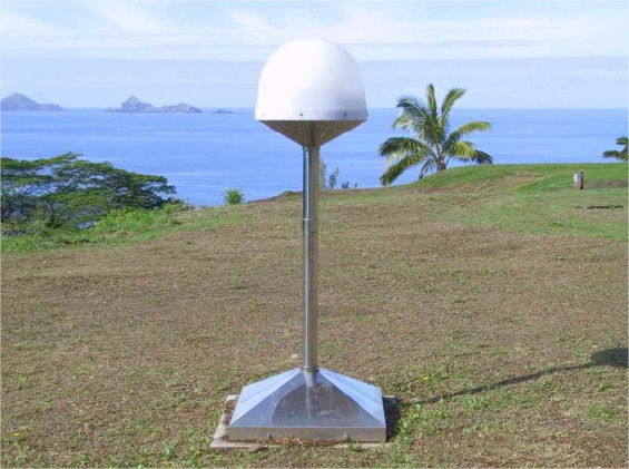
RIKITEA, GAMBIER
Contributing agency


Station summaryGAMB


| IGS-type acronym : | GAMB |
| Latitude : | -23.13035835 |
| Longitude : | -134.96481560 |
| Installed date : | 2000-03-27 |
| Decommissioned date : | |
| Country : | FRANCE |
| City: | RIKITEA, GAMBIER |
| Station status : | active (green) |
| Distance to Tide Gauge (m) : | 1462 |
| Domes Nr.: | 92301M003 |
| Station operator: | (IGN) - Institut National de l'Information Géographique et Forestière (CNES) - Centre National d"Etudes Spatiales |
| IGS-like station form : |
GPS position times seriesGAMB
(Reference epoch: )
| M | Material change or malfunction |
| E | Earthquake |
| RF | Reference Frame change |
| U | Unknown |
| NA | Not available |
| Position discontinuity | |
| Velocity discontinuity |
Data available at SONELGAMB
Quality plots on RINEX filesGAMB
 |
 |
Plots generated using software developed with the EPN team at ROB |
| Observations & tracking performance | Satellite tracking |
 (this operation may take 20 to 45s)
The satellite tracking graph has been calculated for all stations for the first day of each month. If you wish to have a graph for another date, choose the 'Calculate a specific date' option.
Co-located instrumentsGAMB
- Doris : RIKITEA (RIKB)
- Tide gauge : RIKITEA (RIKIW)
- GPS : Rikitea Wharf (RKTG)
- Doris : RIKITEA (RILB)
- Doris : RIKITEA (RIMB)
Leveling & DatumsGAMB
Photo albumGAMB
BibliographyGAMB
If you have a relevant reference to suggest, please send-us an e-mail : sonel@sonel.org-
 A.-Martínez-Asensio, G.-Wöppelmann et al., 2019. Relative sea-level rise and the influence of vertical land motion at Tropical Pacific Islands. Global and Planetary Change.


-
Ballu, Gravelle et al., 2019. Vertical land motion in the Southwest and Central Pacific from available GNSS solutions and implications for relative sea levels. Geophysical Journal International.
-
Xianjie-Li, Jean-Pierre-Barriot et al., 2023. Monitoring absolute vertical land motions and absolute sea-level changes from GPS and tide gauges data over French Polynesia. Geodesy and Geodynamics.
Log bookGAMB
[IGSSTATION-7975] - 2020-06-10 (10/06/2020)
A firmware upgrade was done for GAMB station. New sitelog has been submitted to IGS.
3.14 Receiver Type : TRIMBLE NETR9
Satellite System : GPS GLO GAL BDS SBAS
Serial Number : 5025K68523
Firmware Version : 5.42
Elevation Cutoff Setting : 0 deg
Date Installed : 2019-10-16T09:15Z
Date Removed : 2020-06-10T02:00Z
Temperature Stabiliz. : 25.0 C ± 3.0 C
Additional Information :
3.15 Receiver Type : TRIMBLE NETR9
Satellite System : GPS GLO GAL BDS SBAS
Serial Number : 5025K68523
Firmware Version : 5.45
Elevation Cutoff Setting : 0 deg
Date Installed : 2020-06-10T02:10Z
Date Removed : CCYY-MM-DDThh:mmZ
Temperature Stabiliz. : 25.0 C ± 3.0 C
Additional Information :


