
PLYMOUTH
Station summaryPMTH


| IGS-type acronym : | PMTH |
| Latitude : | 50.41646944 |
| Longitude : | -4.12618333 |
| Installed date : | 2004-02-13 |
| Decommissioned date : | |
| Country : | UK |
| City: | PLYMOUTH |
| Station status : | active (green) |
| Distance to Tide Gauge (m) : | 6798 |
| Domes Nr.: | 13229M001 |
| Station operator: | Unknown |
| IGS-like station form : |
GPS position times seriesPMTH
(Reference epoch: )
| M | Material change or malfunction |
| E | Earthquake |
| RF | Reference Frame change |
| U | Unknown |
| NA | Not available |
| Position discontinuity | |
| Velocity discontinuity |
Data available at SONELPMTH
Quality plots on RINEX filesPMTH
 |
 |
Plots generated using software developed with the EPN team at ROB |
| Observations & tracking performance | Satellite tracking |
 (this operation may take 20 to 45s)
The satellite tracking graph has been calculated for all stations for the first day of each month. If you wish to have a graph for another date, choose the 'Calculate a specific date' option.
Comparison with satellite altimetry data
- Link to Sea Level Differences (Satellite altimetry minus tide gauge data).
Co-located instrumentsPMTH
- Tide gauge : DEVONPORT (DEVON)
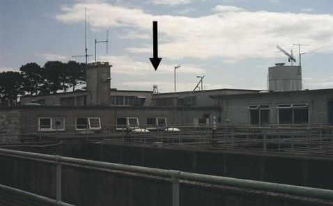
Photo albumPMTH
Log bookPMTH
[EUREFmail-9447] - 2018-06-18 (19/06/2018)
The station log files for stations ADAR, ARIS, CHIO, INVR, PMTH, SNEO have today been amended. The receivers at these stations were recently upgraded to models capable of GPS GLO GAL BDS. However, we are not yet sending 4 constellation data until our receiver upgrade programme is complete. So, the log files now show the tracked constellations as GPS GAL.
[EUREFmail-9400] - 2018-05-09 (15/05/2018)
The receiver at station PMTH was changed yesterday from 'LEICA GRX1200 GNSS' to 'SEPT POLAR RX5'. A new log file has been submitted to the EPN.


