
ILE ROYALE
Contributing agency


Station summaryIRYL


| IGS-type acronym : | IRYL |
| Latitude : | 5.28467393 |
| Longitude : | -52.58675124 |
| Installed date : | 2013-09-27 |
| Decommissioned date : | 2022-05-16 |
| Country : | FRANCE |
| City: | ILE ROYALE |
| Station status : | Decommissioned (white and red cross) |
| Distance to Tide Gauge (m) : | 2 |
| Domes Nr.: | 97309M001 |
| Station operator: | (LIENSs - OASU) - LIENSs - OASU (DM-GUYANE) - Service des Phares et Balises de Guyane |
| IGS-like station form : |
GPS position times seriesIRYL
(Reference epoch: )
| M | Material change or malfunction |
| E | Earthquake |
| RF | Reference Frame change |
| U | Unknown |
| NA | Not available |
| Position discontinuity | |
| Velocity discontinuity |
Data available at SONELIRYL
Quality plots on RINEX filesIRYL
 |
 |
Plots generated using software developed with the EPN team at ROB |
| Observations & tracking performance | Satellite tracking |
 (this operation may take 20 to 45s)
The satellite tracking graph has been calculated for all stations for the first day of each month. If you wish to have a graph for another date, choose the 'Calculate a specific date' option.
Co-located instrumentsIRYL
- Tide gauge : ILE ROYALE (ROYAL)
- Tide gauge : ILE ROYALE - ANSE LEGOFF (LEGOF)
- GPS : Ile Royale (IROY)
Leveling & DatumsIRYL
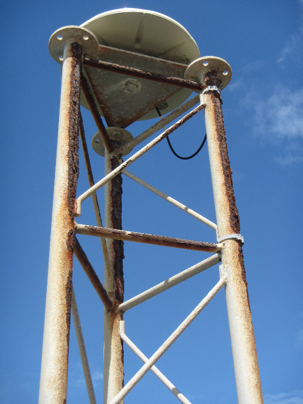
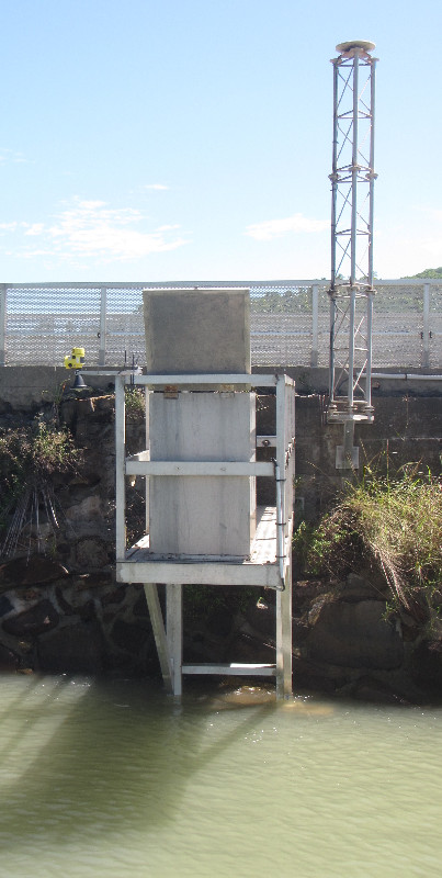
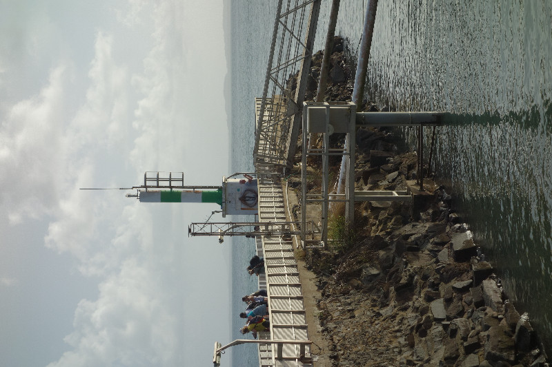
Photo albumIRYL

_1_3414.JPG)
| Titre du document sécurisé | Vignette |
|---|---|
| GNSS antenna and tide gauge |

(31 Ko) |
voir rubrique contact
BibliographyIRYL
If you have a relevant reference to suggest, please send-us an e-mail : sonel@sonel.org-
 BAIZEAU, 2020. CR intervention île royale 17-18 octobre 2020. Direction de la mer de Guyane.
-
Delaugerre, DONAL, 2014. Installation de la station GNSS permanente IRYL sur l’Île Royale en Guyane. Rapport Technique IGN/SGN, RT/G 176.
-
DONAL, 2024. Rénovation de la station GNSS de l’île Royale Guyane, mai 2022. Compte rendu IGN, DT 60082 8730.
-
Enet, 2021. Intervention sur le MCN de l’Île Royale, Guyane. SHOM.
-
Thiéblemont, Le-Cozannet et al., 2023. Chronic flooding events due to sea-level rise in French Guiana. Scientific Reports.


Log bookIRYL
2022-05-16 (01/06/2022)
Intervention by the SHOM and IGN to change the mast support of the GNSS antenna. Now, the support is in stainless steel.
2020-12-17 (17/12/2020)
There has been a SHOM mission on Is. Royale from 7th to 11th of December 2020. Since the 11th, various test have been done on the GNSS config but the router is down and no GNSS nor TG high frequency data are sent for the moment.
E.Poirier
2020-12-11 (11/12/2020)
There was a problem in the processing of the GNSS data by IGN. This will be solved shortly. Since the 17th of October 2020, date of receiver replacement, the data have been correctly sent by the receiver to IGS server. Nothing has been lost. E.Poirier
2020-10-17 (04/11/2020)
2020-10-17/ 10:45Z GNSS receiver Trimble netr9 removed.
2020-10-17/ 11:20Z GNSS receiver Trimble Alloy installed.
However the data cannot be sent for the moment. There is still network issues.
E.Poirier (ULR)
[RGPmail] - 2019-11-21 (27/11/2019)
La station IRYL (973, Guyane) n'est plus en mesure de fournir un service de positionnement depuis la session 307k. Une intervention sur place est programmée pour le 28 novembre prochain.
The IRYL GNSS station (973, Guyane) dataflow stopped on 2019-307k. A technical team should try to solve the problem on the site from 28 November 2019
[RGPmail] - 2018-02-08 (16/02/2018)
The data for the IRYL station (973, Guyana), stopped on 2017-06-13 are now available since session 2018-031b. Missing data are definitely lost.
---------------
Les données de la station IRYL (973, Guyane), mise en panne sur notre site le 13/06/2017, sont de nouveau disponibles depuis la session 031b.
Les données manquantes ne pourront pas être récupérées.


