
ROOMASSAARE
Contributing agency

Station summaryKURE


| IGS-type acronym : | KURE |
| Latitude : | 58.25563333 |
| Longitude : | 22.51005278 |
| Installed date : | 2007-11-15 |
| Decommissioned date : | |
| Country : | ESTONIA |
| City: | KURESSAARE |
| Station status : | active (green) |
| Distance to Tide Gauge (m) : | 4657 |
| Domes Nr.: | 10604S001 |
| Station operator: | (ELB) - Estonian Land Board |
| IGS-like station form : |
GPS position times seriesKURE
Position
(Reference epoch: )
(Reference epoch: )
Offsets (mm)
| M | Material change or malfunction |
| E | Earthquake |
| RF | Reference Frame change |
| U | Unknown |
| NA | Not available |
| Position discontinuity | |
| Velocity discontinuity |
Data available at SONELKURE
Quality plots on RINEX filesKURE
 |
 |
Plots generated using software developed with the EPN team at ROB |
| Observations & tracking performance | Satellite tracking |
 (this operation may take 20 to 45s)
The satellite tracking graph has been calculated for all stations for the first day of each month. If you wish to have a graph for another date, choose the 'Calculate a specific date' option.
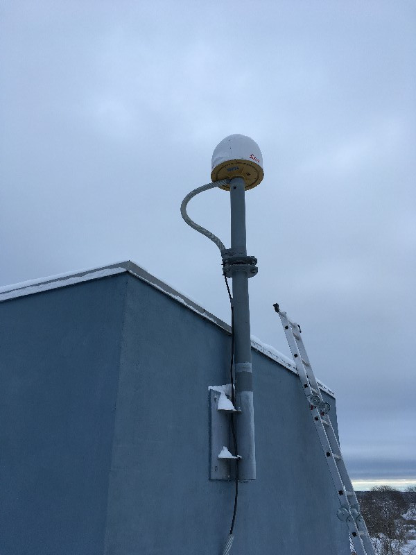
Co-located instrumentsKURE
- Tide gauge : ROOMASSAARE (RSATG)
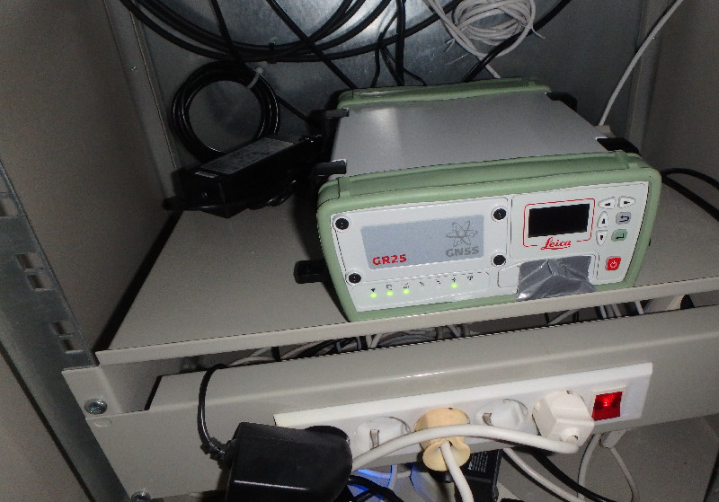
Photo albumKURE
Log bookKURE
[EUREFmail-10220] - 2020-04-14 (14/04/2020)
The submission of RINEX2 data from sites KURE, SUR4, TOIL and TOR2 will be stopped on April 14, 2020.
[EUREFmail-10209] - 2020-04-06 (14/04/2020)
The Measurement Engine (ME) of Leica GR25 receivers has been updated from 6.712 to 6.713.
Log files of KURE, SUR4, TOIL and TOR2 have been updated.
[EUREFmail-09992] - 2019-09-30 (01/10/2019)
The firmware of the Leica GR25 receivers in KURE, SUR4, TOIL and TOR2 has been upgraded. Updated site logs are available at M3G.


