
ANTALYA
Station summaryANTA


| IGS-type acronym : | ANTA |
| Latitude : | 36.83335400 |
| Longitude : | 30.61672100 |
| Installed date : | 2003-11-21 |
| Decommissioned date : | |
| Country : | TURKEY |
| City: | ANTALYA |
| Station status : | Survey (blue) |
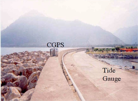
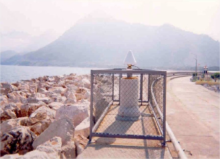
| Distance to Tide Gauge (m) : | 400 |
| Domes Nr.: | 20812M002 |
| Station operator: | Unknown |
| IGS-like station form : |
Co-located instrumentsANTA
- Tide gauge : ANTALYA II (ANTTG)
Photo albumANTA
BibliographyANTA
If you have a relevant reference to suggest, please send-us an e-mail : sonel@sonel.org-
 Anzidei, Antonioli et al., 2011. Sea level change and vertical land movements since the last two millennia along the coasts of southwestern Turkey and Israel. Quaternary International.


-
Ozturk, Marwan et al., 2018. A New Centennial Sea‐Level Record for Antalya, Eastern Mediterranean. Journal of Geophysical Research.
-
Sezen, Baybura, 2010. The investigation of long-term sea level variations at Antalya-I (1935-1977) and Antalya-II (1985-2005) Tide Gauge Stations (Turkey). Scientific Research and Essays.
-
Yildiz, Andersen et al., 2013. Estimates of vertical land motion along the southwestern coasts of Turkey from coastal altimetry and tide gauge data. Advances in Space Research.


