
MARE
Contributing agency


Station summaryMRTG

GNSS-IR


| IGS-type acronym : | MRTG |
| Latitude : | -21.54756161 |
| Longitude : | 167.87579345 |
| Installed date : | 2015-11-05 |
| Decommissioned date : | |
| Country : | FRANCE |
| City: | MARE |
| Station status : | No data for 30 days (orange) |
| Distance to Tide Gauge (m) : | 2 |
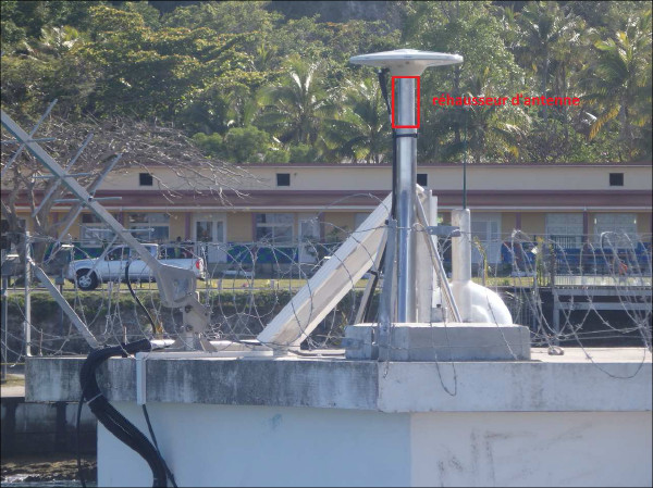
| Domes Nr.: | 92748M001 |
| Station operator: | (DITTT) - Direction des Infrastructures, de la Topographie et des Transports Terrestres |
| IGS-like station form : |
GPS position times seriesMRTG
Position
(Reference epoch: )
(Reference epoch: )
Offsets (mm)
| M | Material change or malfunction |
| E | Earthquake |
| RF | Reference Frame change |
| U | Unknown |
| NA | Not available |
| Position discontinuity | |
| Velocity discontinuity |
Data available at SONELMRTG
Quality plots on RINEX filesMRTG
 |
 |
Plots generated using software developed with the EPN team at ROB |
| Observations & tracking performance | Satellite tracking |
 (this operation may take 20 to 45s)
The satellite tracking graph has been calculated for all stations for the first day of each month. If you wish to have a graph for another date, choose the 'Calculate a specific date' option.
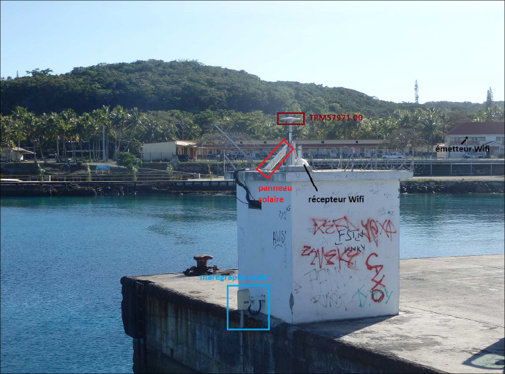
Co-located instrumentsMRTG
- Tide gauge : MARE (MRETG)
Leveling & DatumsMRTG
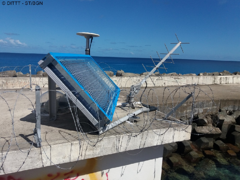
Photo albumMRTG


BibliographyMRTG
If you have a relevant reference to suggest, please send-us an e-mail : sonel@sonel.org-
 DITTT, 2015. Installation d’une station GNSS permanente à Tadine sur l’île de Maré (Novembre 2015).


