
ILE D'AIX
Station summary


| Responsible organization: | link to REFMAR web page |
| Latitude : | 46.00735300 |
| Longitude : | -1.17433300 |
| Start date: | 2011-03-22 |
| End date: | |
| Country: | FRANCE |
| City: | ILE D'AIX |
| Station state: | VERT |
Mean sea level
Daily means
Monthly means
Annual means
Calculating the mean sea levels
Links to data sources

Co-located instrumentsILAIX
- GPS : ILE D'AIX (ILDX)
Leveling & DatumsILAIX
Photo albumILAIX
BibliographyILAIX
If you have a relevant reference to suggest, please send-us an e-mail : sonel@sonel.org-
 André, 2013. Measuring sea level with GPS-equipped buoys: a multi-instruments experiement at Aix Island. International Hydrographic Review.

-
Chupin, Ballu et al., 2020. Mapping Sea Surface Height Using New Concepts of Kinematic GNSS Instruments. Remote Sensing.

-
Dodet, Bertin et al., 2019. Characterization of Sea-level Variations Along the Metropolitan Coasts of France: Waves, Tides, Storm Surges and Long-term Changes.
-
Gobron, de-Viron et al., 2019. Assessment of tide gauges biases and precisions by the combination of multiple co-located time series. Journal of Atmospheric and Oceanic Technology.
-
Gouriou, 2013. Reconstruction of a two-century long sea level record for the Pertuis d'Antioche (France). Continental Shelf Research.
-
Gouriou, 2012. Evolution des composantes du niveau marin à partir d'observations de marégraphie effectuées depuis la fin du 18ème siècle en Charente-Maritime. Université de la Rochelle.
-
KEREBEL, 2021. CR Mission - 04/05/2021 au 05/05/2021.
-
Vu, Frappart et al., 2018. Multi-Satellite Altimeter Validation along the French Atlantic Coast in the Southern Bay of Biscay from ERS-2 to SARAL. Remote Sensing.
Logbook
2017-06 (25/05/2022)
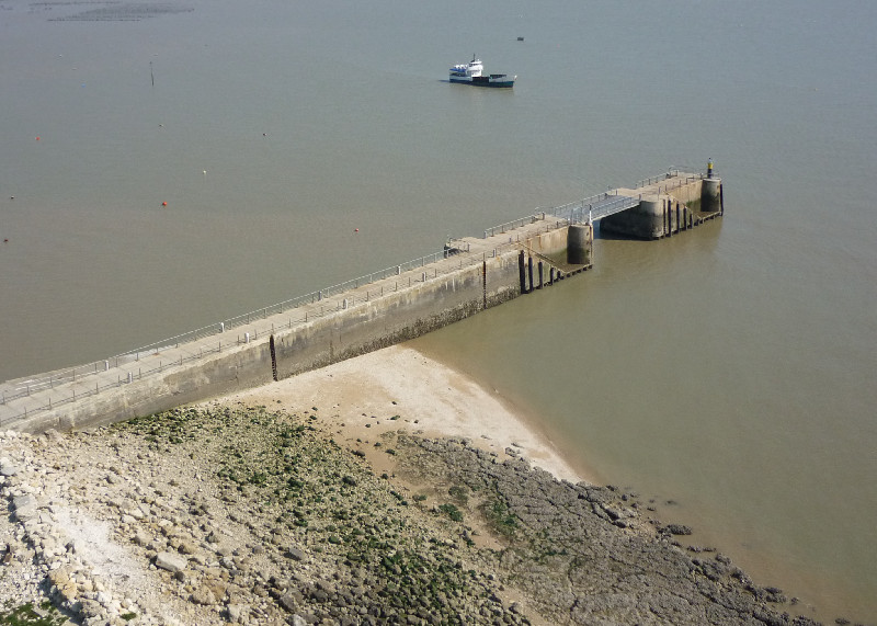
The DDTM made an intervention in the area of the tide gauge. I was contacted by Pierre Durand de Gevigney of the Charente-Maritime Department to access the tide gauge enclosure on the Barbotin jetty. This in order to disassemble a railing to make metal thickness measurements in order to decide how to renovate the railing of the jetty. The intervention was carried out without the presence of SONEL. They used duplicate keys located at the yacht club’s local. Etienne Poirier2019-11-03 (25/05/2022)
"Amélie" storm the 3rd november of 2021 during the morning. Wind gusts exceeded 130km/h.2019-12-12 (25/05/2022)
Construction work in progress, hydro-demolition to dig two trenches in the jetty of the island of Aix. They have already been at work for about a month. Malfunctions are observed on the tide gauge due to a very rainy period with very little sunlight. Photovoltaic panels and batteries are not enough. We did a trip with Pierre Durand de Gevigney and his colleague Alexandra, who works at the management of the port of Charentaise maritime. We could not access to the jetty where I had planned to indicate the locations of the electrical cabinets as it is submerged by the waves. We tour the site and inspect the PAPI dike. E. Poirier2021-08-03 (25/05/2022)
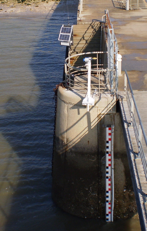
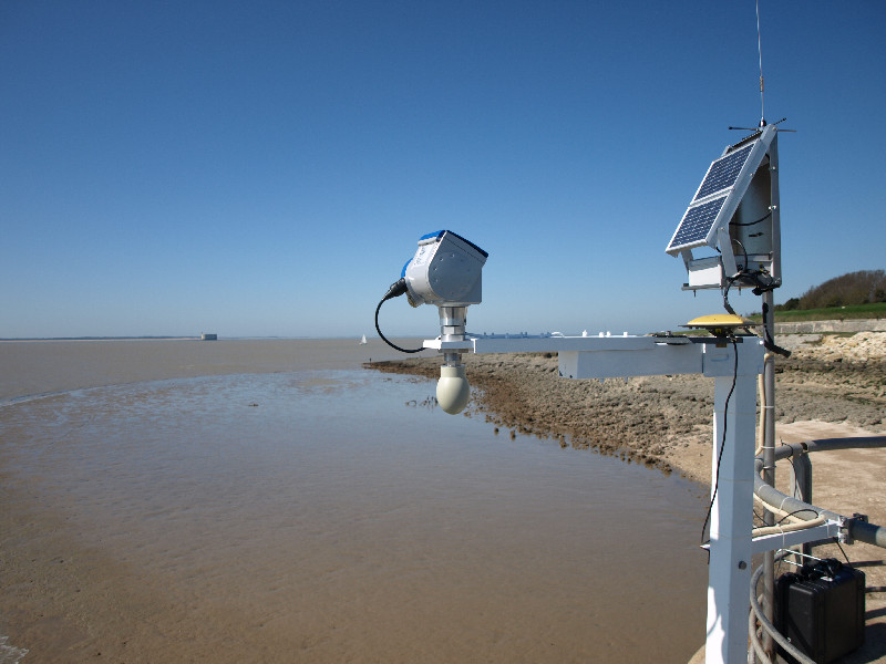
Installation of a GNSS antenna receiver to get reflectometry data. Etienne Poirier and I levelled the antenna with the tide gauge and one of the benchmark of the FOM. V. Kérébel2021-08-11 (25/05/2022)
Mission to clean the tide pole and make measurements with 2 VEGAPULS radars. Measurements with radars were made to compare the data with the previous mission. We were unable to clean up the tide pole because there were too many people on the site and the tide was starting to rise. V. Kérébel2021-11-09 (25/05/2022)
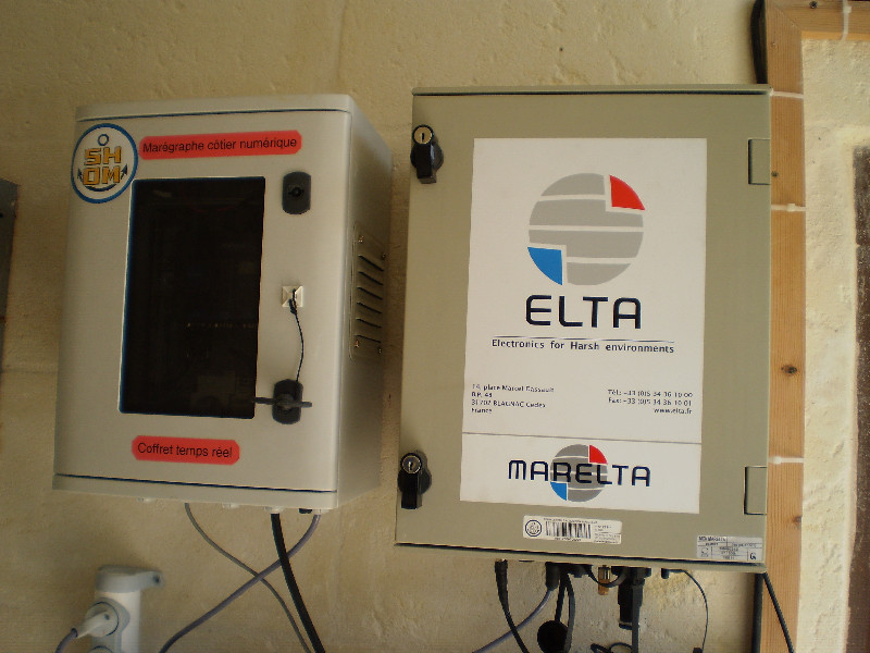
As part of the renewal of RONIM network, SHOM called on Campbell enterprise to change the ILAIX tide gauge. It was completed on November 04, 05 and 09, 2021.I took the opportunity to do a mission with the VegaPULS 61 radars as well as a comparison of the data provided by these radars with a pressure gauge and the CMN. I lent the technician the key to the room. Victor Kérébel
2020-02-04 (09/02/2021)
Shom - ULR mission completed. The TG is now powered by stabilized 12V. The solar panels batteries remain as a saftey power source. E.Poirier.2020-01-22 (23/01/2020)
On site visit to inspect the construction work going on Barbotin jetty.Marking of the future position of 3 electric junction boxes that will be installed by Bouygues Energies Servives on the jetty.
Meeting with the different parties involved in the construction operations.
E. Poirier
2019-11-29 (29/11/2019)
Work in progress at the tide gauge jetty to install a power cable, mew lights, etc... This is done with high pressure water. The work started in October 2019 and should be ended by January/February 2020.2019-06-07 (07/06/2019)
Storm at Aix island 'Miguel'. Starting at 06:00 UTC day 158 and shall continue until 12:00 UTC day 158. Exceptional for this period of the year. Tide gauge records at 1 Hz are logged at ULR. Expected gust 120 km/h. E.Poirier


