
FARADAY BASE
Station summary


Links to data sources

Comparison with satellite altimetry data
- Link to Sea Level Differences (Satellite altimetry minus tide gauge data).
Co-located instrumentsVNATG
- GPS : Vernadsky Station (VNAD)
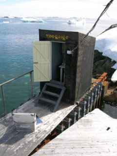
Photo albumVNATG
BibliographyVNATG
If you have a relevant reference to suggest, please send-us an e-mail : sonel@sonel.org-
 Nield, Barletta et al., 2014. Rapid bedrock uplift in the Antarctic Peninsula explained by viscoelastic response to recent ice unloading. Earth and Planetary Science Letters.


-
Woodworth, Hibbert, 2015. Sea-level monitoring in the British verseas Territories. Journal of Operational Oceanography.


