Contributing agency

Station summaryTGWN

GNSS-IR


| IGS-type acronym : | TGWN00DEU |
| Latitude : | 53.80631500 |
| Longitude : | 7.92923000 |
| Installed date : | 2014-06-11 |
| Decommissioned date : | 2016-09-14 |
| Country : | GERMANY |
| City: | WANGEROOGE |
| Station status : | Decommissioned (white and red cross) |
| Domes Nr.: | 99999M019 |
| Station operator: | (BAFG) - Bundesanstalt für Gewässerkunde |
| IGS-like station form : |
Data available at SONELTGWN
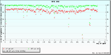
Quality plots on RINEX filesTGWN
 |
 |
Plots generated using software developed with the EPN team at ROB |
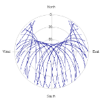
| Observations & tracking performance | Satellite tracking |
 (this operation may take 20 to 45s)
The satellite tracking graph has been calculated for all stations for the first day of each month. If you wish to have a graph for another date, choose the 'Calculate a specific date' option.
Co-located instrumentsTGWN
- GPS : WANGEROOGE-NORD (TGW2)