Contributing agency

Station summaryBNGR


| IGS-type acronym : | BNGR00IRL |
| Latitude : | 54.66567195 |
| Longitude : | -5.67127607 |
| Installed date : | 2016-01-27 |
| Decommissioned date : | |
| Country : | IRELAND |
| City: | BANGOR |
| Station status : | active (green) |
| Distance to Tide Gauge (m) : | 155 |
| Domes Nr.: | 19206S001 |
| Station operator: | (OSNI) - Ordnance Survey Northern Ireland |
| IGS-like station form : |
Data available at SONELBNGR
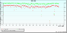
Quality plots on RINEX filesBNGR
 |
 |

Plots generated using software developed with the EPN team at ROB |
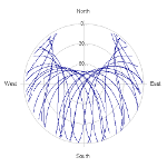
| Observations & tracking performance | Satellite tracking |
 (this operation may take 20 to 45s)
The satellite tracking graph has been calculated for all stations for the first day of each month. If you wish to have a graph for another date, choose the 'Calculate a specific date' option.
Co-located instrumentsBNGR
- Tide gauge : BANGOR (BNGTG)