
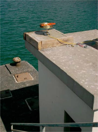
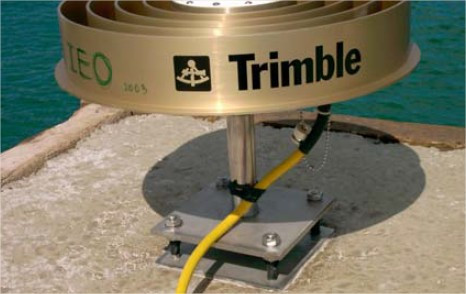
PUERTO DE LA LUZ
Contributing agency

Station summaryPLUZ


| IGS-type acronym : | PLUZ |
| Latitude : | 28.14670892 |
| Longitude : | -15.40760854 |
| Installed date : | 2003-10-29 |
| Decommissioned date : | |
| Country : | SPAIN |
| City: | LAS PALMAS DE GRAN CANARIA |
| Station status : | No data for 30 days (orange) |
| Distance to Tide Gauge (m) : | 1 |
| Domes Nr.: | 31308M001 |
| Station operator: | Unknown |
| IGS-like station form : |
GPS position times seriesPLUZ
Position
(Reference epoch: )
(Reference epoch: )
Offsets (mm)
| M | Material change or malfunction |
| E | Earthquake |
| RF | Reference Frame change |
| U | Unknown |
| NA | Not available |
| Position discontinuity | |
| Velocity discontinuity |
Data available at SONELPLUZ
Quality plots on RINEX filesPLUZ
 |
 |
Plots generated using software developed with the EPN team at ROB |
| Observations & tracking performance | Satellite tracking |
 (this operation may take 20 to 45s)
The satellite tracking graph has been calculated for all stations for the first day of each month. If you wish to have a graph for another date, choose the 'Calculate a specific date' option.
Comparison with satellite altimetry data
- Link to Sea Level Differences (Satellite altimetry minus tide gauge data).
Co-located instrumentsPLUZ
- Tide gauge : LAS PALMAS C (PUERTO DE LA LUZ) (LPALM)
- Tide gauge : LAS PALMAS, PUERTO DE LA LUZ (LPPDL)
- Tide gauge : LAS PALMAS D (LASPD)
- GPS : Universidad de Las Palmas (ULP2)
Leveling & DatumsPLUZ
Photo albumPLUZ
BibliographyPLUZ
If you have a relevant reference to suggest, please send-us an e-mail : sonel@sonel.org-
 Mendes, Barbosa et al., 2017. Vertical land motion and sea level change in Macaronesia. Geophysical Journal International.

-
Molinero, Garcia, 2004. Instalación de Sistema de Posicionamiento Global en la estación mareográfica del Puerto de La luz..


