
TUBUAI
Contributing agency


Station summaryTBTG


| IGS-type acronym : | TBTG00PYF |
| Latitude : | -23.34176500 |
| Longitude : | -149.47554000 |
| Installed date : | 2008-12-03 |
| Decommissioned date : | |
| Country : | FRANCE |
| City: | TUBUAI |
| Station status : | No data for 30 days (orange) |
| Distance to Tide Gauge (m) : | 1 |
| Domes Nr.: | 92401M002 |
| Station operator: |
GOP Contact
|
| IGS-like station form : |
GPS position times seriesTBTG
(Reference epoch: )
| M | Material change or malfunction |
| E | Earthquake |
| RF | Reference Frame change |
| U | Unknown |
| NA | Not available |
| Position discontinuity | |
| Velocity discontinuity |
Data available at SONELTBTG
Quality plots on RINEX filesTBTG
 |
 |
Plots generated using software developed with the EPN team at ROB |
| Observations & tracking performance | Satellite tracking |
 (this operation may take 20 to 45s)
The satellite tracking graph has been calculated for all stations for the first day of each month. If you wish to have a graph for another date, choose the 'Calculate a specific date' option.
Co-located instrumentsTBTG
- Tide gauge : TUBUAI (TUBUA)
Leveling & DatumsTBTG
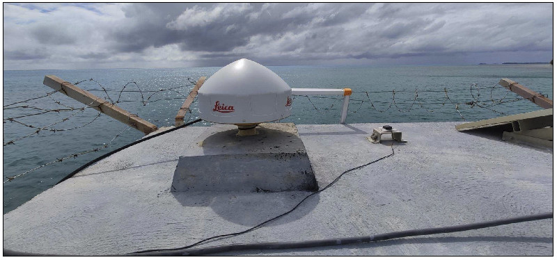
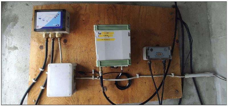
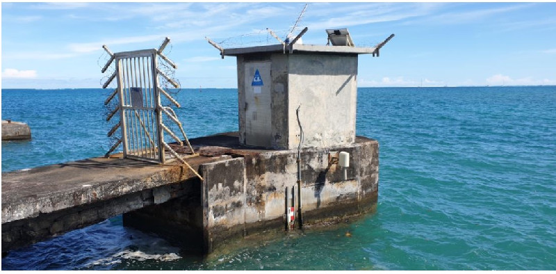
Photo albumTBTG
BibliographyTBTG
If you have a relevant reference to suggest, please send-us an e-mail : sonel@sonel.org-
 A.-Martínez-Asensio, G.-Wöppelmann et al., 2019. Relative sea-level rise and the influence of vertical land motion at Tropical Pacific Islands. Global and Planetary Change.


-
Ballu, Gravelle et al., 2019. Vertical land motion in the Southwest and Central Pacific from available GNSS solutions and implications for relative sea levels. Geophysical Journal International.
-
Xianjie-Li, Jean-Pierre-Barriot et al., 2023. Monitoring absolute vertical land motions and absolute sea-level changes from GPS and tide gauges data over French Polynesia. Geodesy and Geodynamics.
History of the stationTBTG
- April 2021: New receiver and anteanna installed at TBTG by MT Fabien Courbet (Shom)
Log bookTBTG
2020-12-16 (20/05/2021)
A Shom mission took place at Tubuai from 12 to 16 December 2020 (Lagadec, Coubret). During this mission the GNSS receiver Leica GRX1200GG Pro was removed from the station the 2020-12-16. It has been diagnosed broken since 2020-05-26.
Therefore there was no GNSS data logged from 2020-05-26 to 2021-04-20 according to Shom documentation.
GNSS antenna AT504GG has also been removed the same day.
E.Poirier
2021-04-20 (20/05/2021)
On the 20th of April 2021, MT Fabien Coubret went to Tubuai and replaced GNSS antenna and receiver with Leica GR25 and Leica AR20.
Leica GR25 comes from SONEL and has been taken from Rangiroa GNSS site. Rangiroa site is under restoration for the moment. E.Poirier


