
NAIN
Contributing agency

Station summaryNAIN


| IGS-type acronym : | NAIN00CAN |
| Latitude : | 56.53697616 |
| Longitude : | -61.68871817 |
| Installed date : | 2002-12-18 |
| Decommissioned date : | |
| Country : | CANADA |
| City: | NAIN |
| Station status : | No data for 30 days (orange) |
| Distance to Tide Gauge (m) : | 730 |
| Domes Nr.: | 40164M001 |
| Station operator: | (NRCan) - National Resources Canada |
| IGS-like station form : |
GPS position times seriesNAIN
(Reference epoch: )
| M | Material change or malfunction |
| E | Earthquake |
| RF | Reference Frame change |
| U | Unknown |
| NA | Not available |
| Position discontinuity | |
| Velocity discontinuity |
Data available at SONELNAIN
Quality plots on RINEX filesNAIN
 |
 |
Plots generated using software developed with the EPN team at ROB |
| Observations & tracking performance | Satellite tracking |
 (this operation may take 20 to 45s)
The satellite tracking graph has been calculated for all stations for the first day of each month. If you wish to have a graph for another date, choose the 'Calculate a specific date' option.
Co-located instrumentsNAIN
- Tide gauge : NAIN (NAITG)
Leveling & DatumsNAIN
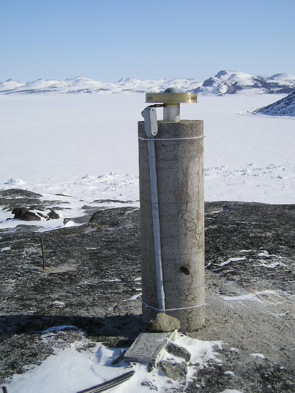
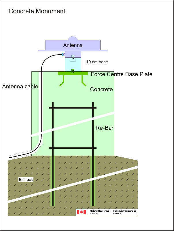
Photo albumNAIN
Log bookNAIN
[IGSSTATION-6696] - 2016-06-17 (17/06/2016)
The Ashtech Micro-Z receiver at NAIN has been experiencing a tracking problem that began on Day 163 and became progressively worse. Data for Days 167
[IGSSTATION-6258] - 2015-07-31 (08/02/2016)
NAIN has been off-line since Day 210 due to a power outage in the community. Although power is back on, the receiver will no longer power on. I will advise after further investigation and possible replacement of the receiver.
[IGSSTATION-5778] - 2014-05-11 (12/05/2014)
Data for Nain was lost from 23:40:00 on Day 126 (May 6) to 02:05:30 on Day 127 (May 7). There are also several data gaps on day 127. Tracking now appears to be back to normal.


