
NICE
Station summary


| Responsible organization: | link to REFMAR web page |
| Latitude : | 43.69559860 |
| Longitude : | 7.28550005 |
| Start date: | |
| End date: | |
| Country: | FRANCE |
| City: | NICE |
| Station state: | VERT |
Mean sea level
Daily means
Monthly means
Annual means
Calculating the mean sea levels
Links to data sources

Leveling & DatumsNICE1
Photo albumNICE1

BibliographyNICE1
If you have a relevant reference to suggest, please send-us an e-mail : sonel@sonel.org-
 Dodet, Bertin et al., 2019. Characterization of Sea-level Variations Along the Metropolitan Coasts of France: Waves, Tides, Storm Surges and Long-term Changes.


-
F.-Birol, N.-Fuller et al., 2017. Coastal applications from nadir altimetry: Example of the X-TRACK regional products. Advances in Space Research.
-
Florence-Birol, Caroline-Delebecque, 2014. Using high sampling rate (10/20Hz) altimeter data for the observation of coastal surface currents: A case study over the northwestern Mediterranean Sea. Journal of Marine Systems.
Logbook
2022-01-12 (31/05/2022)
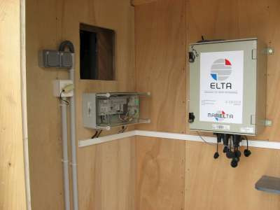
Intervention by the SHOM to change the acquisition central of the tide gauge. Before it was an Elta system, now it is a Campbell. Also, installation of the meteorological sensor METSENS500 and a camera MOBOTIX.Le 19/02/2010 (08/04/2010)
Relance du MCN. Archivage des données.Le 18/03/1998 (06/04/2010)
Installation d'un Marégraphe Côtier Numérique (MCN): capteur ultrason I2E NUS 30 et centrale d'acquisition MORS HT200.Le 25/09/2007 (06/04/2010)
Démontage du marégraphe pour travaux.Le 26/05/2008 (06/04/2010)
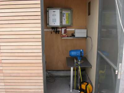
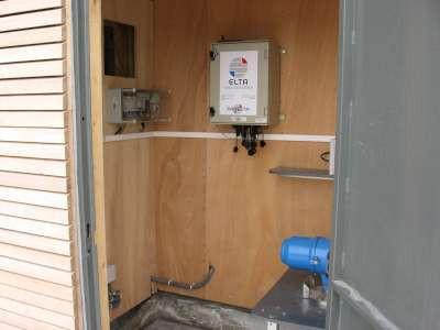
Installation d'un nouveau marégraphe: capteur radar Krohne BM70 (de type FMCW) et centrale d'acquisition ELTA.Le 11/09/2008 (06/04/2010)
Il manque des données: du 25/09/2007 au 27/05/2008, suite au démontage du MCN lors des travaux.Le 20/10/2008 (06/04/2010)
Problème de connexion au marégraphe. L'interrogation automatique du week-end ne s'est pas faite. Impossible d'appeler, problème de connexion. Les partenaires sur place essaient de trouver l'origine du problème.Le 26/11/2009 (11/12/2009)
Relance du MCN.Archivage des données à 10 min et HH.
Le 05/11/2008 (23/03/2009)
Intervention sur place de nos partenaires: connexion de nouveau possible.History of this station


