
LEVELING OF BOULOGNE-SUR-MER
Benchmark positionning related to the tide gauge station
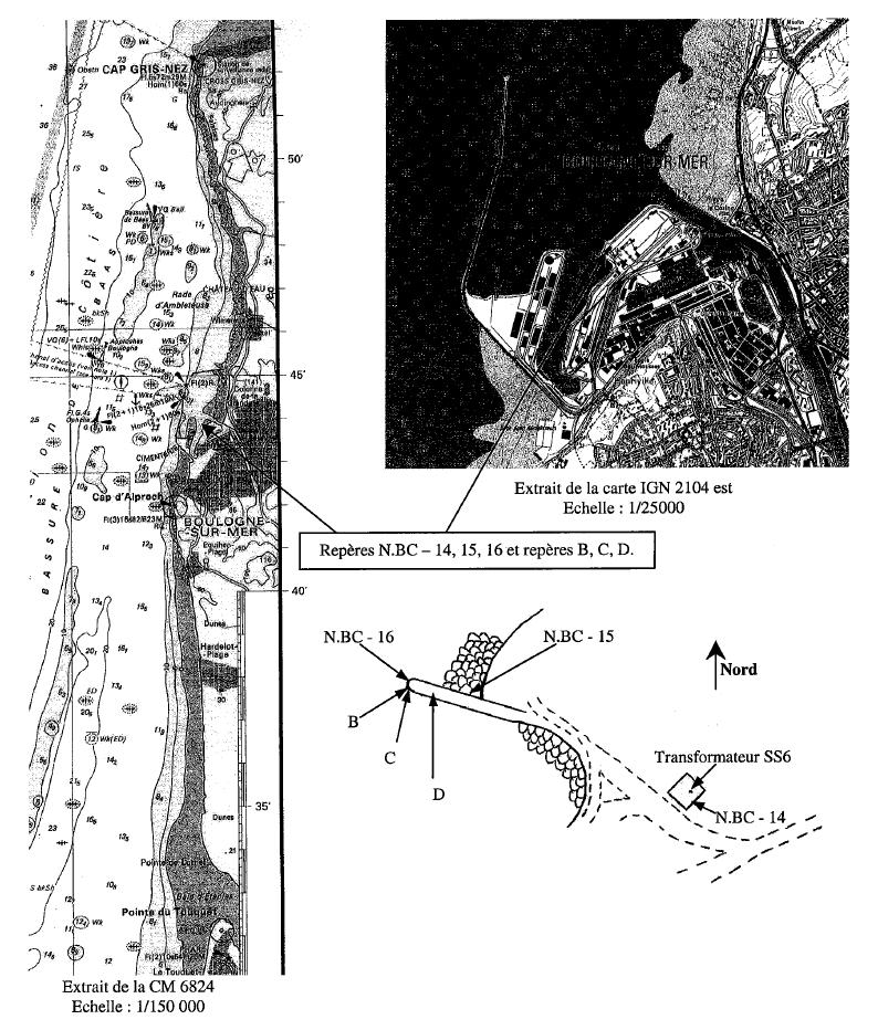
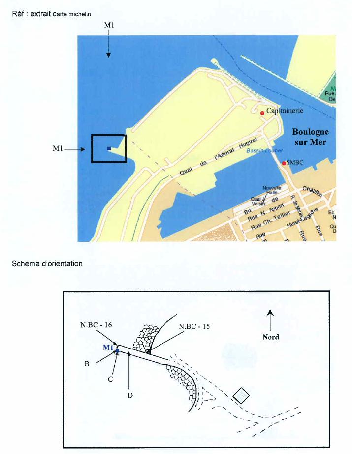
Benchmarks description table
Benchmarks vertical positionning diagram
Reference:
Leveling evolution
| Stand point | N.BC - 15 | N.BC - 15 | N.BC - 15 | C | D | D | N.BC - 16 | ||
|---|---|---|---|---|---|---|---|---|---|
| End point | D | N.BC - 14 | N.BC - 16 | N.BC - 16 | N.BC - 16 | B | B | ||
| Distance (m) | ---- | 181 | 57 | ---- | ---- | ---- | ---- | ||
| Height difference (m) | Campaign 4 | 2016-10-04 | --- | --- | --- | --- | --- | --- | --- |
| Campaign 3 | 2012-11-29 | --- | --- | --- | --- | --- | --- | --- | |
| Campaign 2 | 2006-02-16 | 0.2300 ± 0.001 | --- | --- | 0.0280 ± 0.001 | 0.0220 ± 0.001 | 0.4560 ± 0.001 | --- | |
| Campaign 1 | 2002-07-10 | --- | 1.0780 ± 0.001 | 0.2520 ± 0.001 | 0.0350 ± 0.001 | 0.0210 ± 0.001 | --- | 0.4250 ± 0.001 | |
| Height difference evolution graph |  |  |  |  |  |  |  | ||
Download leveling data
TIDE GAUGE LOCAL LEVELING NETWORK DATA OF STATION Equihen
-----------------------------------------------------------------------------------------------------
Benchmark Lat. Long. Height Year of determination St.dev Distance_to_TG
10chr (°) 14chr (°) 14chr (m) 10chr 22chr (m)10chr (m) 10chr
-----------------------------------------------------------------------------------------------------
N.BC - 14 50.726500 1.580694 13.847 2002 0.00000 5220
N.BC - 15 50.727417 1.578583 10.673 2016 0.00100 5290
N.BC - 16 50.727417 1.577778 10.928 2016 0.00100 5290
B ---- ---- 13.455 2006 0.00200 ----
C ---- ---- 12.993 2006 0.00100 ----
D ---- ---- 10.904 2016 0.00100 ----
N.BC-3 BIS ---- ---- 12.867 2016 0.00000 ----
N.BC-9 ---- ---- 9.794 2016 0.00100 ----
N.BC-10 ---- ---- 11.262 2016 0.00100 ----
G ---- ---- 10.842 2016 0.00100 ----
I ---- ---- 10.993 2016 0.00100 ----
K ---- ---- 12.461 2016 0.00100 ----
L ---- ---- 10.900 2016 0.00100 ----
N ---- ---- 13.860 2016 0.00100 ----
H ---- ---- ---- ---- ---- ----
N.BC-2BIS ---- ---- ---- ---- ---- ----
A ---- ---- ---- ---- ---- ----
F ---- ---- ---- ---- ---- ----
J ---- ---- ---- ---- ---- ----
Co-located instruments
- Tide Gauge : BOULOGNE-SUR-MER (BOULO)
- GPS : Equihen (EQHE)
- GPS : Equihen (EQH2)


