
LEVELING OF MARION ISLAND
Benchmark positionning related to the tide gauge station
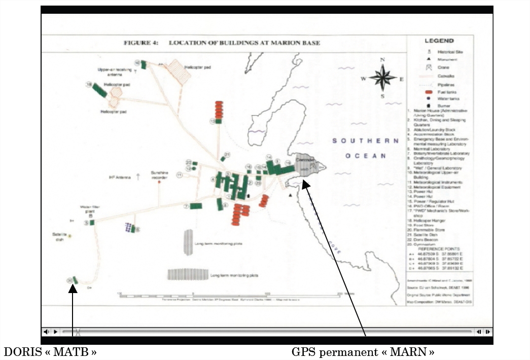
Benchmarks description table
Leveling evolution
| Stand point | MATB | DORIS/Mark | ||
|---|---|---|---|---|
| End point | MARN | MATB | ||
| Distance (m) | 409 | ---- | ||
| Height difference (m) | Campaign 1 | 2006-11-09 | -30.2650 ± 0.01 | 2.4310 ± 0.001 |
| Height difference evolution graph |  |  | ||
Download leveling data
TIDE GAUGE LOCAL LEVELING NETWORK DATA OF STATION MARION IS.
-----------------------------------------------------------------------------------------------------
Benchmark Lat. Long. Height Year of determination St.dev Distance_to_TG
10chr (°) 14chr (°) 14chr (m) 10chr 22chr (m)10chr (m) 10chr
-----------------------------------------------------------------------------------------------------
MATB -46.878905 37.856997 ---- ---- ---- 410
MARN -46.876455 37.860993 ---- ---- ---- 10
DORIS/Mark ---- ---- ---- ---- ---- ----
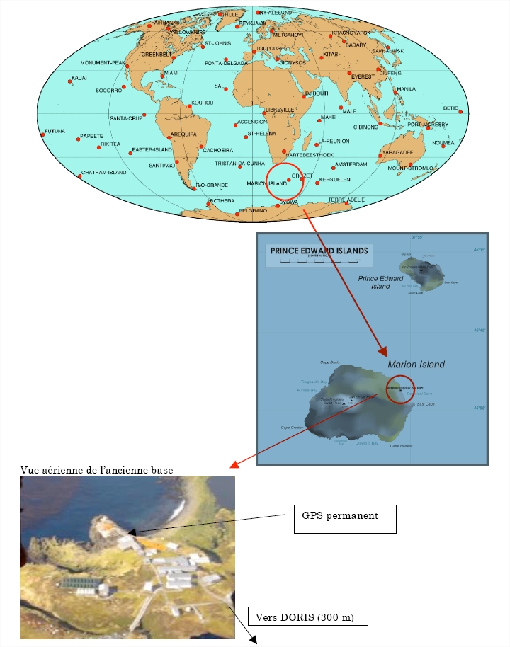
Co-located instruments
- Doris : MARION ISLAND (MATB)
- Tide Gauge : MARION ISLAND (MISTG)
- GPS : MARION IS. (MARN)
- Doris : MARION ISLAND (MARA)
- Doris : MARION ISLAND (MARB)


