
KERGUELEN
Contributing agency


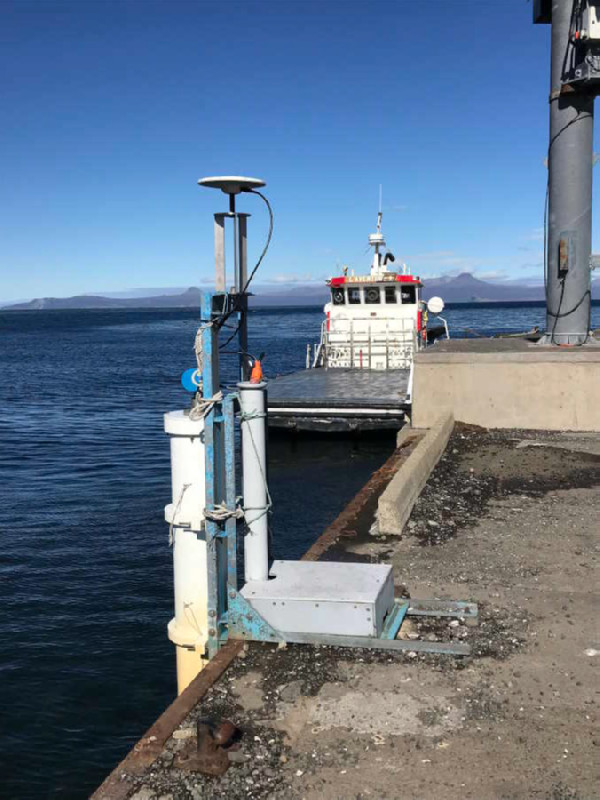
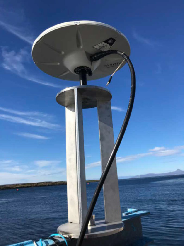
Station summaryKERR

GNSS-IR


| IGS-type acronym : | KERR00ATF |
| Latitude : | -49.35219955 |
| Longitude : | 70.21900177 |
| Installed date : | 2024-04-01 |
| Decommissioned date : | |
| Country : | FRANCE |
| City: | PORT-AUX-FRANCAIS |
| Station status : | No data for 30 days (orange) |
| Distance to Tide Gauge (m) : | 1 |
| Domes Nr.: | |
| Station operator: | (IGN) - Institut National de l'Information Géographique et Forestière (LIENSs-OASU) - LIENSs - OASU |
| IGS-like station form : |
GPS position times seriesKERR
Position
(Reference epoch: )
(Reference epoch: )
Offsets (mm)
| M | Material change or malfunction |
| E | Earthquake |
| RF | Reference Frame change |
| U | Unknown |
| NA | Not available |
| Position discontinuity | |
| Velocity discontinuity |
Data available at SONELKERR
Quality plots on RINEX filesKERR
 |
 |
Plots generated using software developed with the EPN team at ROB |
| Observations & tracking performance | Satellite tracking |
 (this operation may take 20 to 45s)
The satellite tracking graph has been calculated for all stations for the first day of each month. If you wish to have a graph for another date, choose the 'Calculate a specific date' option.
Co-located instrumentsKERR
- GPS : Kerguelen Islands (KERG)
- Tide gauge : KERGUELEN (KERGU)
- GPS : Kerguelen Island 2 (KRGG)
- GPS : Kerguelen - Pilier NIVMER (KETG)
- Doris : KERGUELEN (KEWC)
Leveling & DatumsKERR
Photo albumKERR
Log bookKERR
2025-04-12 OP1-2025 (26/06/2025)
The GNSS receiver does not track any satellites. After checking the antenna cable, the receiver was turn off and then back on. Tracking and positionning have resumed.
This problem started in October 2024 after a power outage.
To date, the station is operating normally


