
DUBROVNIK
Station summaryDUBR


| IGS-type acronym : | DUBR00HRV |
| Latitude : | 42.64998280 |
| Longitude : | 18.11043347 |
| Installed date : | 2000-09-22 |
| Decommissioned date : | 2012-09-19 |
| Country : | CROATIA |
| City: | DUBROVNIK |
| Station status : | Decommissioned (white and red cross) |
| Distance to Tide Gauge (m) : | 4168 |
| Domes Nr.: | 11901M001 |
| Station operator: | (SGA) - State Geodetic Administration |
| IGS-like station form : |
GPS position times seriesDUBR
Position
(Reference epoch: )
(Reference epoch: )
Offsets (mm)
| M | Material change or malfunction |
| E | Earthquake |
| RF | Reference Frame change |
| U | Unknown |
| NA | Not available |
| Position discontinuity | |
| Velocity discontinuity |
Data available at SONELDUBR
Quality plots on RINEX filesDUBR
 |
 |
Plots generated using software developed with the EPN team at ROB |
| Observations & tracking performance | Satellite tracking |
 (this operation may take 20 to 45s)
The satellite tracking graph has been calculated for all stations for the first day of each month. If you wish to have a graph for another date, choose the 'Calculate a specific date' option.
Comparison with satellite altimetry data
- Link to Sea Level Differences (Satellite altimetry minus tide gauge data).
Co-located instrumentsDUBR
- Tide gauge : DUBROVNIK (DUBTG)
- GPS : Dubrovnik2 (DUB2)
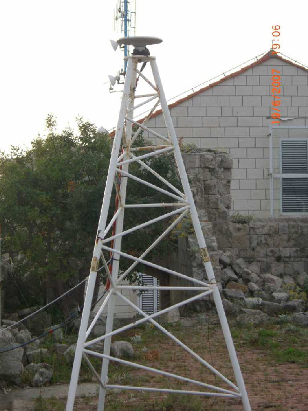
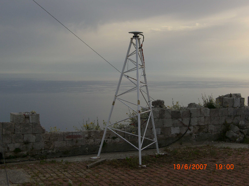
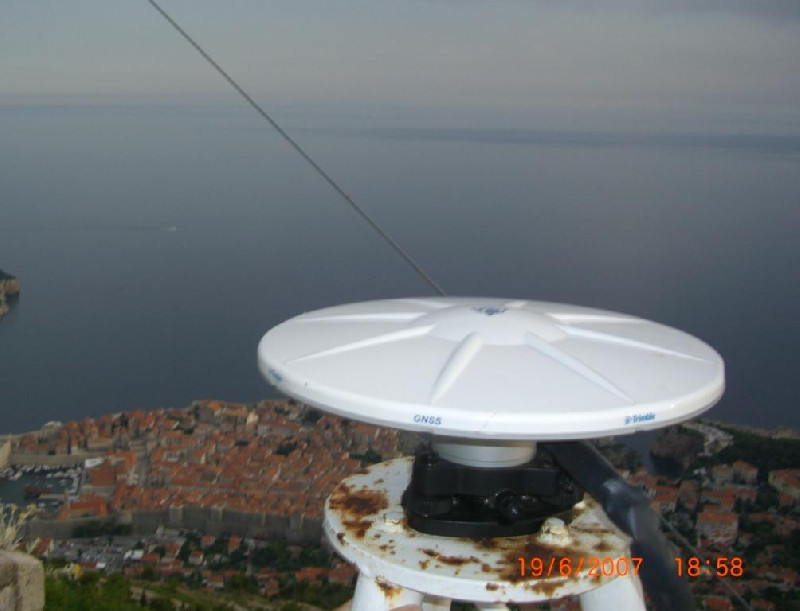
Photo albumDUBR
BibliographyDUBR
If you have a relevant reference to suggest, please send-us an e-mail : sonel@sonel.org-
 De-Biasio, Baldin et al., 2020. Revisiting Vertical Land Motion and Sea Level Trends in the Northeastern Adriatic Sea Using Satellite Altimetry and Tide Gauge Data. Journal of Marine Science and Engineering.


-
Grgic, Bender et al., 2020. Estimating Vertical Land Motion from Remote Sensing and In-Situ Observations in the Dubrovnik Area (Croatia): A Multi-Method Case Study. Remote Sensing.
-
Vignudelli, De-Biasio, 2021. Coastal Sea Level Trends from a Joint Use of Satellite Radar Altimetry, GPS and Tide Gauges: Case Study of the Northern Adriatic Sea. Geodetic Sciences - Theory, Applications and Recent Developments.
Log bookDUBR
[IGSSTATION-5010] - 2012-07-13 (19/09/2012)
CROPOS is upgrading to VRS3Net software. Installation and testing of the new software will take place from July 29th till August 4th 2012. Therefore, data from station DUBR will not be available in that period.
[EUREFmail-6597] - 2012-09-19 (19/09/2012)
station DUBR will be closed down today and will became a former station. However, 15 meters away from DUBR station there is a proposed EPN site DUB2 which is fully operational.


