
UA POU
Contributing agency


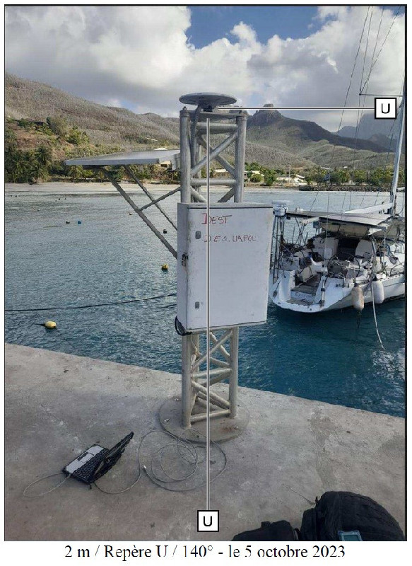
Station summaryHKTG


| IGS-type acronym : | HKTG00PYF |
| Latitude : | -9.35788000 |
| Longitude : | -140.04645300 |
| Installed date : | 2023-10-05 |
| Decommissioned date : | |
| Country : | FRANCE |
| City: | HAKAHAU |
| Station status : | No data for 30 days (orange) |
| Distance to Tide Gauge (m) : | 2 |
| Domes Nr.: | 92101M001 |
| Station operator: | (SHOM) - Service Hydrographique et Océanographique de la Marine |
| IGS-like station form : |
GPS position times seriesHKTG
Position
(Reference epoch: )
(Reference epoch: )
Offsets (mm)
| M | Material change or malfunction |
| E | Earthquake |
| RF | Reference Frame change |
| U | Unknown |
| NA | Not available |
| Position discontinuity | |
| Velocity discontinuity |
Data available at SONELHKTG
Quality plots on RINEX filesHKTG
 |
 |
Plots generated using software developed with the EPN team at ROB |
| Observations & tracking performance | Satellite tracking |
 (this operation may take 20 to 45s)
The satellite tracking graph has been calculated for all stations for the first day of each month. If you wish to have a graph for another date, choose the 'Calculate a specific date' option.
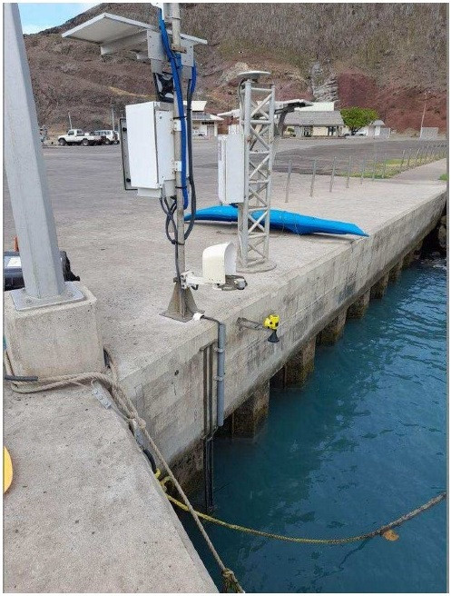
Co-located instrumentsHKTG
- Tide gauge : Hakahau (HAKAH)
Leveling & DatumsHKTG
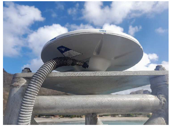
Photo albumHKTG


BibliographyHKTG
If you have a relevant reference to suggest, please send-us an e-mail : sonel@sonel.org-
 Laborde, 2024. Visite de maintien en conditions opérationnelles de la station de surveillance du niveau de la mer de Ua Pou (MCO01 – léger). Groupe océanographique du Pacifique - Base hydrographique de Polynésie française. N° 29/Shom/GOP/BHPF/NP..


