
LYTTELTON
Station summaryLYTT

GNSS-IR


| IGS-type acronym : | LYTT00NZL |
| Latitude : | -43.60584331 |
| Longitude : | 172.72222274 |
| Installed date : | 1999-11-15 |
| Decommissioned date : | 2019-01-02 |
| Country : | NEW ZEALAND |
| City: | LYTTELTON |
| Station status : | Decommissioned (white and red cross) |
| Distance to Tide Gauge (m) : | 2 |
| Domes Nr.: | 50214S001 |
| Station operator: | (uOtago) - University of Otago |
| IGS-like station form : |
GPS position times seriesLYTT
Position
(Reference epoch: )
(Reference epoch: )
Offsets (mm)
| M | Material change or malfunction |
| E | Earthquake |
| RF | Reference Frame change |
| U | Unknown |
| NA | Not available |
| Position discontinuity | |
| Velocity discontinuity |
Data available at SONELLYTT
Quality plots on RINEX filesLYTT
 |
 |
Plots generated using software developed with the EPN team at ROB |
| Observations & tracking performance | Satellite tracking |
 (this operation may take 20 to 45s)
The satellite tracking graph has been calculated for all stations for the first day of each month. If you wish to have a graph for another date, choose the 'Calculate a specific date' option.
Comparison with satellite altimetry data
- Link to Sea Level Differences (Satellite altimetry minus tide gauge data).
Co-located instrumentsLYTT
- GPS : McQueens Valley (MQZG)
- Tide gauge : PORT LYTTELTON (LYTTG)
- Tide gauge : LYTTELTON II (LYTT2)
- GPS : Lyttelton (LY2T)
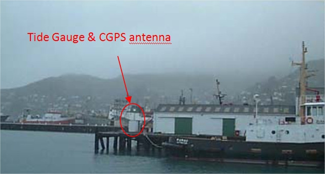
Photo albumLYTT
BibliographyLYTT
If you have a relevant reference to suggest, please send-us an e-mail : sonel@sonel.org-
 Denys, Beavan et al., 2020. Sea Level Rise in New Zealand: The Effect of Vertical Land Motion on Century‐Long Tide Gauge Records in a Tectonically Active Region. Journal of Geophysical Research: Solid Earth.

-
Gravalon, Seoane et al., 2021. The impact of barometric variations on the sea level in coastal areas using GNSS reflectometry. IGARSS Conference.
-
Gravalon, Seoane et al., 2022. Determination of weather-induced short-term sea level variations by GNSS reflectometry. Remote Sensing of Environment.


