
LEVELING OF NICE
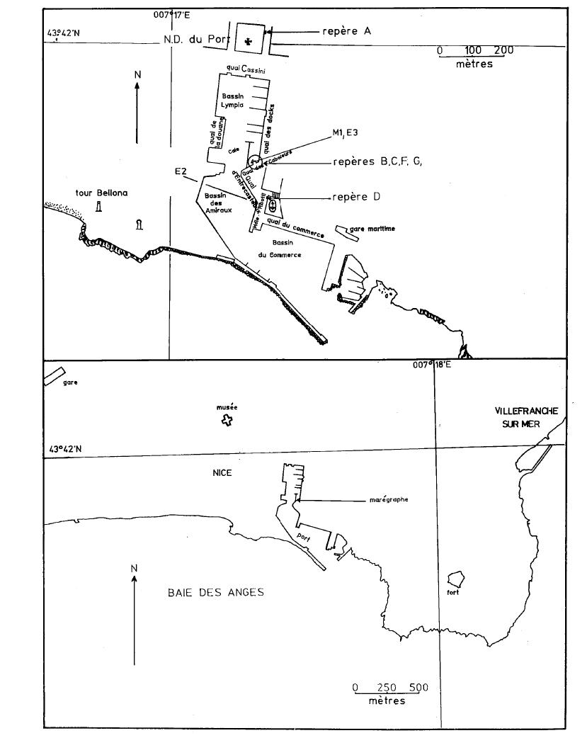
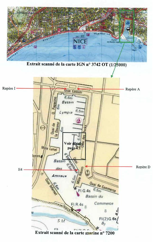
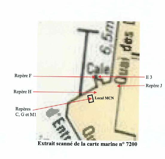
Benchmark positionning related to the tide gauge station
Benchmarks description table
Benchmarks vertical positionning diagram
Reference:
Leveling evolution
| Stand point | E4 | H | F | F | C | C | C | G | D | J | I | ||
|---|---|---|---|---|---|---|---|---|---|---|---|---|---|
| End point | A | A | A | C | A | G | D | A | A | A | A | ||
| Distance (m) | ---- | ---- | ---- | ---- | ---- | ---- | ---- | ---- | 408 | ---- | 36 | ||
| Height difference (m) | Campaign 4 | 2023-09-20 | --- | --- | --- | --- | --- | --- | --- | --- | --- | --- | --- |
| Campaign 3 | 2013-06-28 | --- | --- | --- | --- | --- | --- | --- | --- | --- | --- | --- | |
| Campaign 2 | 2007-06-27 | 6.0980 ± 0.001 | 5.7780 ± 0.001 | 5.7410 ± 0.001 | --- | 5.6240 ± 0.001 | --- | --- | 5.0970 ± 0.001 | 4.6780 ± 0.001 | 4.3560 ± 0.001 | 0.3370 ± 0.001 | |
| Campaign 1 | 1998-03-18 | --- | --- | --- | 0.1190 ± 0.001 | --- | 0.5200 ± 0.003 | 0.9450 ± 0.001 | --- | --- | --- | --- | |
| Height difference evolution graph |  |  |  |  |  |  |  |  |  |  |  | ||
Download leveling data
TIDE GAUGE LOCAL LEVELING NETWORK DATA OF STATION NICE
-----------------------------------------------------------------------------------------------------
Benchmark Lat. Long. Height Year of determination St.dev Distance_to_TG
10chr (°) 14chr (°) 14chr (m) 10chr 22chr (m)10chr (m) 10chr
-----------------------------------------------------------------------------------------------------
A 43.698667 7.285500 14.267 2023 0.00000 340
B ---- ---- ---- ---- ---- ----
C ---- ---- 8.643 2007 0.00100 ----
D 43.695028 7.286194 9.612 2023 0.00200 80
E4 ---- ---- 8.177 2013 0.00200 ----
F ---- ---- 8.549 2023 0.00200 ----
G ---- ---- 9.170 2007 0.00100 ----
H ---- ---- 8.511 2023 0.00200 ----
I 43.698694 7.285056 13.939 2023 0.00100 350
J ---- ---- 9.934 2023 0.00200 ----
K ---- ---- 7.777 2023 0.00300 ----
L ---- ---- 8.834 2023 0.00200 ----
N ---- ---- 8.558 2023 0.00300 ----
O ---- ---- 9.126 2023 0.00300 ----
P ---- ---- 9.032 2023 0.00200 ----
R ---- ---- 14.106 2023 0.00200 ----
Sommet E1 ---- ---- 6.523 2023 0.00300 ----


