Contributing agency

Station summarySBDT


| IGS-type acronym : | SBDT00ITA |
| Latitude : | 42.95520000 |
| Longitude : | 13.88970000 |
| Installed date : | 2016-02-12 |
| Decommissioned date : | |
| Country : | ITALY |
| City: | SAN BENEDETTO DEL TRONTO |
| Station status : | active (green) |
| Distance to Tide Gauge (m) : | 10 |
| Domes Nr.: | 14682M001 |
| Station operator: | (ISPRA) - Istituto Superiore per la Protezione e la Ricerca Ambientale |
| IGS-like station form : |
Data available at SONELSBDT
Quality plots on RINEX filesSBDT
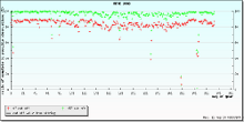 |
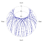 |

Plots generated using software developed with the EPN team at ROB |
| Observations & tracking performance | Satellite tracking |
 (this operation may take 20 to 45s)
The satellite tracking graph has been calculated for all stations for the first day of each month. If you wish to have a graph for another date, choose the 'Calculate a specific date' option.
Co-located instrumentsSBDT
- Tide gauge : SAN BENEDETTO DEL TRONTO (MRRTG)
- GPS : Martinsicuro (MRRA)
Photo albumSBDT
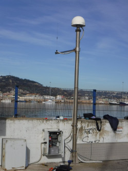
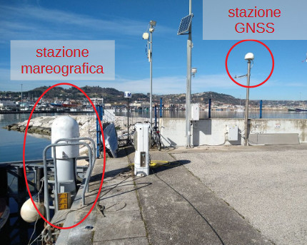
History of the stationSBDT
Link to the technical document : https://gnss.isprambiente.it/data/open_download/monografie/Monografia_SBDT.pdf