
PAPEETE
Contributing agency


Station summaryPAPE

GNSS-IR


| IGS-type acronym : | PAPE00PYF |
| Latitude : | -17.53308500 |
| Longitude : | -149.57271800 |
| Installed date : | 2003-08-06 |
| Decommissioned date : | |
| Country : | FRANCE |
| City: | PAPEETE |
| Station status : | active (green) |
| Distance to Tide Gauge (m) : | 1 |
| Domes Nr.: | 92201M011 |
| Station operator: | (CNES) - Centre National d"Etudes Spatiales (UPF) - Université de la Polynesie francaise |
| IGS-like station form : |
GPS position times seriesPAPE
Position
(Reference epoch: )
(Reference epoch: )
Offsets (mm)
| M | Material change or malfunction |
| E | Earthquake |
| RF | Reference Frame change |
| U | Unknown |
| NA | Not available |
| Position discontinuity | |
| Velocity discontinuity |
Data available at SONELPAPE
Quality plots on RINEX filesPAPE
 |
 |
Plots generated using software developed with the EPN team at ROB |
| Observations & tracking performance | Satellite tracking |
 (this operation may take 20 to 45s)
The satellite tracking graph has been calculated for all stations for the first day of each month. If you wish to have a graph for another date, choose the 'Calculate a specific date' option.
Comparison with satellite altimetry data
- Link to Sea Level Differences (Satellite altimetry minus tide gauge data).
Co-located instrumentsPAPE
- GPS : TAHITI (THTI)
- Tide gauge : PAPEETE (PAPEE)
- Doris : PAPEETE (PATB)
- GPS : Tahiti-Faaa (FAA1)
- GPS : Tahiti - NGA (TAH1)
- GPS : Tahiti - NGA (TAH2)
- GPS : Papeete Tahiti (THTG)
- Doris : PAPEETE (PAPB)
- Doris : PAPEETE (PAQB)
- Doris : PAPEETE (PAUB)
- GPS : Papeete (PPT1)
Leveling & DatumsPAPE
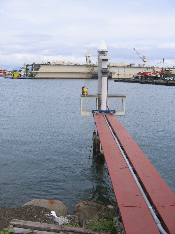
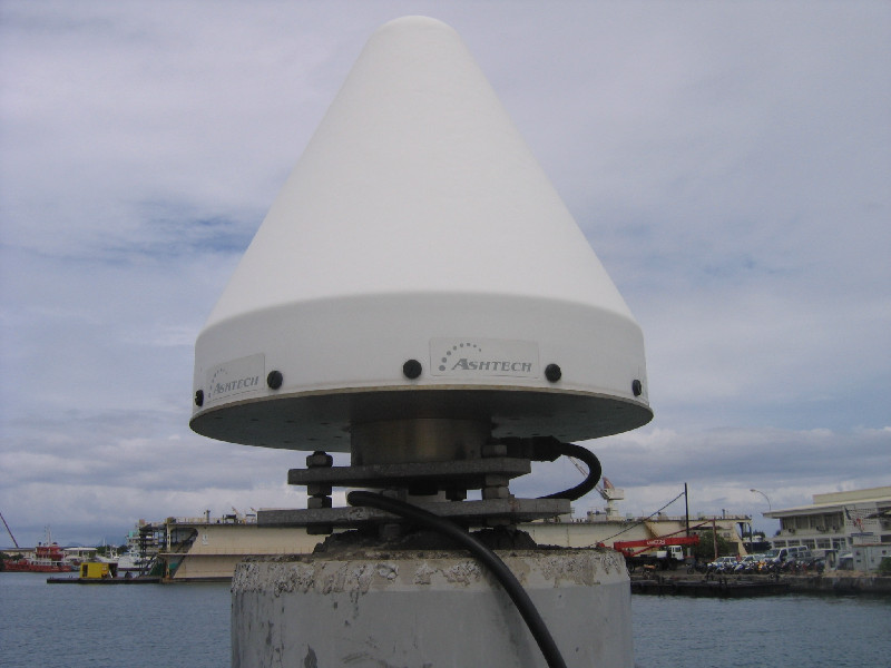
Photo albumPAPE
BibliographyPAPE
If you have a relevant reference to suggest, please send-us an e-mail : sonel@sonel.org-
 A.-Martínez-Asensio, G.-Wöppelmann et al., 2019. Relative sea-level rise and the influence of vertical land motion at Tropical Pacific Islands. Global and Planetary Change.


-
Ballu, Gravelle et al., 2019. Vertical land motion in the Southwest and Central Pacific from available GNSS solutions and implications for relative sea levels. Geophysical Journal International.
-
Woodworth, Rowe, 2018. The tidal measurements of James Cook during the voyage of the Endeavour. History of Geo- and Space Sciences.


