
TAKORADI
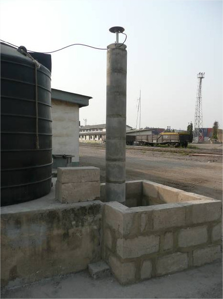
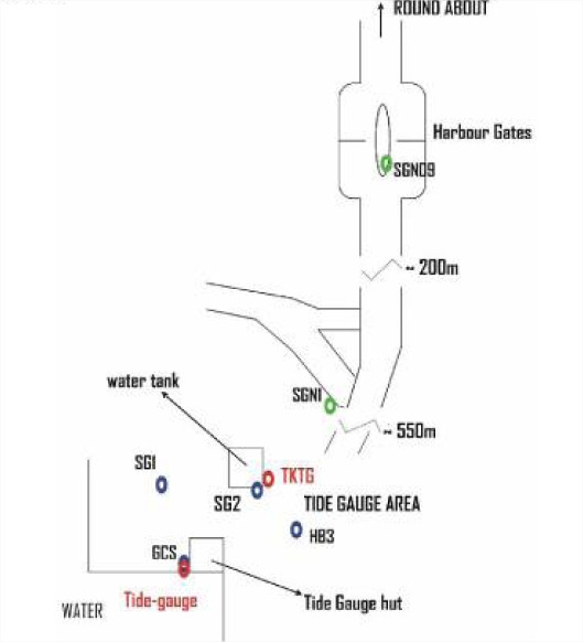
Station summaryTKTG


| IGS-type acronym : | TKTG |
| Latitude : | 4.88763300 |
| Longitude : | -1.74450700 |
| Installed date : | |
| Decommissioned date : | |
| Country : | GHANA |
| City: | TAKORADI |
| Station status : | Survey (blue) |
| Distance to Tide Gauge (m) : | 43 |
| Domes Nr.: | |
| Station operator: | Unknown |
| IGS-like station form : |
Photo albumTKTG
BibliographyTKTG
If you have a relevant reference to suggest, please send-us an e-mail : sonel@sonel.org-
 Fernandes, Bata et al., 2008. The GUITA project: a contribution for interdisciplinary monitoring of sea-level in Africa .
-
Woodworth, Aman et al., 2007. Sea level monitoring in Africa. African Journal of Marine Science.


