
CROZET
Contributing agency


Station summaryCZTG


| IGS-type acronym : | CZTG00ATF |
| Latitude : | -46.43189648 |
| Longitude : | 51.85527777 |
| Installed date : | 2014-03-14 |
| Decommissioned date : | |
| Country : | FRANCE |
| City: | CROZET |
| Station status : | active (green) |
| Distance to Tide Gauge (m) : | 901 |
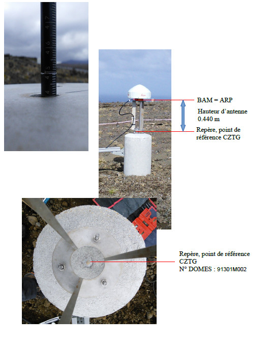
| Domes Nr.: | 91301M002 |
| Station operator: | Unknown |
| IGS-like station form : |
GPS position times seriesCZTG
(Reference epoch: )
| M | Material change or malfunction |
| E | Earthquake |
| RF | Reference Frame change |
| U | Unknown |
| NA | Not available |
| Position discontinuity | |
| Velocity discontinuity |
Data available at SONELCZTG
Quality plots on RINEX filesCZTG
 |
 |
Plots generated using software developed with the EPN team at ROB |
| Observations & tracking performance | Satellite tracking |
 (this operation may take 20 to 45s)
The satellite tracking graph has been calculated for all stations for the first day of each month. If you wish to have a graph for another date, choose the 'Calculate a specific date' option.
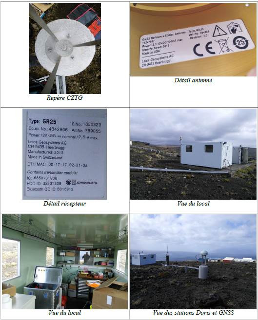
Co-located instrumentsCZTG
- Tide gauge : CROZET (CROZE)
- Doris : CROZET (CRRC)
- GPS : Crozet Reflectometry (CZTR)
Leveling & DatumsCZTG
Photo albumCZTG
_1_3452.jpg)
_1_3452.JPG)
BibliographyCZTG
If you have a relevant reference to suggest, please send-us an e-mail : sonel@sonel.org-
 Guillerm, Velut, 2014. CR Nivmer 2014.
-
Guillot, Santamaría-Gómez, 2018. CR Mission NIVMER 2018. DT INSU, SONEL.
Log bookCZTG
2020/04/10 - doy 101- RINEX2 creation isssue fixed (10/04/2020)
We have noticed a problem in the creation of the RINEX2 files from the raw data since the 2020/03/18 - DOY 78 for CZTG station.
However from doy 78 to doy 101, RINEX2 data have been retrieved (thank you RGP) and are available at SONEL server. They are also available at IGN and IGS.
The RINEX3 did not suffer from that and are available at IGN and IGS.
No raw data have been lost.
E.Poirier
[IGSSTATION-7475] - 2018-12-04 (11/12/2018)
Please note that on November 15th (2018/319) , the receiver at station CZTG was changed from Leica GR25 to Trimble NetR9.


