
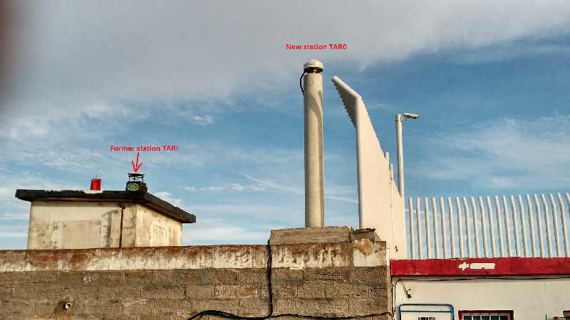
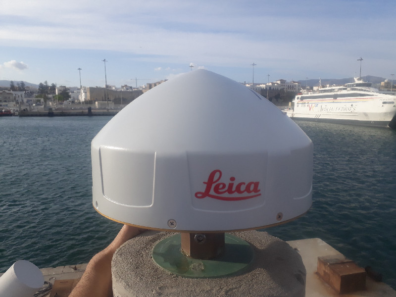
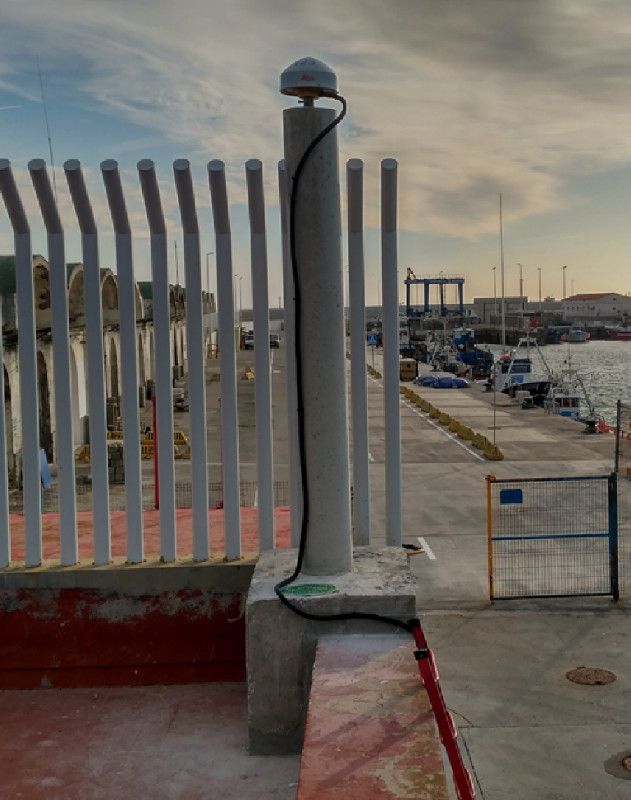
TARIFA
Contributing agency

Station summaryTAR0


| IGS-type acronym : | TAR000ESP |
| Latitude : | 36.00855115 |
| Longitude : | -5.60269468 |
| Installed date : | 2019-06-06 |
| Decommissioned date : | |
| Country : | SPAIN |
| City: | TARIFA |
| Station status : | active (green) |
| Distance to Tide Gauge (m) : | 8 |
| Domes Nr.: | 19350M002 |
| Station operator: | (IGNE) - Instituto Geografico Nacional |
| IGS-like station form : |
GPS position times seriesTAR0
(Reference epoch: )
| M | Material change or malfunction |
| E | Earthquake |
| RF | Reference Frame change |
| U | Unknown |
| NA | Not available |
| Position discontinuity | |
| Velocity discontinuity |
Data available at SONELTAR0
Quality plots on RINEX filesTAR0
 |
 |
Plots generated using software developed with the EPN team at ROB |
| Observations & tracking performance | Satellite tracking |
 (this operation may take 20 to 45s)
The satellite tracking graph has been calculated for all stations for the first day of each month. If you wish to have a graph for another date, choose the 'Calculate a specific date' option.
Co-located instrumentsTAR0
Leveling & DatumsTAR0
Photo albumTAR0
BibliographyTAR0
If you have a relevant reference to suggest, please send-us an e-mail : sonel@sonel.org-
 Gravalon, Seoane et al., 2021. The impact of barometric variations on the sea level in coastal areas using GNSS reflectometry. IGARSS Conference.
-
Gravalon, Seoane et al., 2022. Determination of weather-induced short-term sea level variations by GNSS reflectometry. Remote Sensing of Environment.


Log bookTAR0
[EUREFmail-11619] - 2024-01-04 (17/01/2024)
Author: Jose A. Sanchez Sobrino
Subject: TAR000ESP: 6 cm subsidence
Dear colleagues,
Due to works in the dock of the port where the station TAR0 is located, it has suffered a subsidence of 6 cm
between DOYs 347 and 355 (2023). Since then, it has stabilised, but still we don't know if the station has to be decommissioned.
Best regards
Jose Antonio Sanchez Sobrino
Instituto Geografico Nacional
C/ General Ibanez de Ibero, 3 jassobrino@fomento.es
28003 Madrid - SPAIN
[EUREFmail-09978] - 2019-09-16 (26/09/2019)
We are glad to announce that from September 15, 2019 on, one new
permanent GNSS station will be included in the EUREF Permanent
Network : the station TAR000ESP (Tarifa) is operated by the Instituto
Geografico Nacional de Espana (see
ftp://epncb.eu/pub/center/oper/IGE.OC).
Type antenna calibration values for that station (LEIAR20/LEIM)
are included in ftp://epncb.eu/pub/station/general/epn_14.atx.
The complete station log can be retrieved from the EUREF permanent
network Central Bureau : ftp://epncb.eu/pub/station/log_9char or
through the web-page of the station
(http://www.epncb.eu/_networkdata/siteinfo4onestation.php?station=TAR000ESP).
The Ocean Loading tables
ftp://epncb.eu/pub/station/general/EPN_GOT002.BLQ,
ftp://epncb.eu/pub/station/general/EPN_FES2004.BLQ and
ftp://epncb.eu/pub/station/general/EPN_FES2004_CMC.BLQ
have been updated in order to include that station.
The daily and hourly RINEX 2 (GPS GLO) and RINEX 3 (GPS GLO GAL)
data are available from the BKG and BEV EPN regional data centres.
Real-time data is available from the EPN regional brodacaster ROB.
The data of TAR000ESP are processed by the ASI, BEK, IGE and WUT
analysis centres.
We expect to see the results in the EUREF combined solution from
GPS WK 2071 on.


