
MAWSON
Contributing agency

Station summaryMAW1


| IGS-type acronym : | MAW100ATA |
| Latitude : | -67.60480000 |
| Longitude : | 62.87070000 |
| Installed date : | 1994-01-01 |
| Decommissioned date : | |
| Country : | ANTARCTICA |
| City: | MAWSON |
| Station status : | active (green) |
| Distance to Tide Gauge (m) : | 488 |
| Domes Nr.: | 66004M001 |
| Station operator: | (GA) - Geoscience Australia |
| IGS-like station form : |
GPS position times seriesMAW1
(Reference epoch: )
| M | Material change or malfunction |
| E | Earthquake |
| RF | Reference Frame change |
| U | Unknown |
| NA | Not available |
| Position discontinuity | |
| Velocity discontinuity |
Data available at SONELMAW1
Quality plots on RINEX filesMAW1
 |
 |
Plots generated using software developed with the EPN team at ROB |
| Observations & tracking performance | Satellite tracking |
 (this operation may take 20 to 45s)
The satellite tracking graph has been calculated for all stations for the first day of each month. If you wish to have a graph for another date, choose the 'Calculate a specific date' option.
Co-located instrumentsMAW1
- Tide gauge : MAWSON (MAWSO)
Leveling & DatumsMAW1
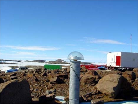
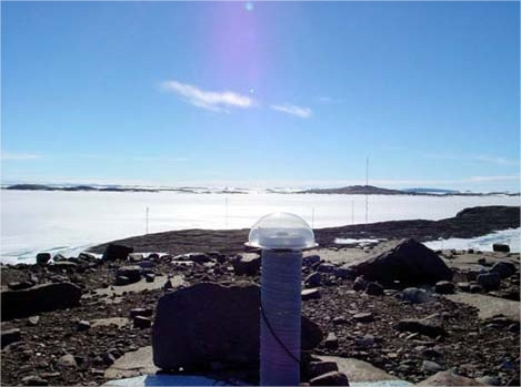
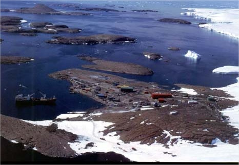
Photo albumMAW1

Log bookMAW1
[IGSSTATION-7911] - 2020-03-10 (18/03/2020)
MAW100ATA has been restored. The issue was not with the antenna, but with the powered splitter. The unit has now been repaired and the site is back online.
[IGSSTATION-7900] - 2020-02-27 (18/03/2020)
The antenna at station MAW100ATA appears to be faulty. As a result, all data from station is currently unavailable.
We are currently arranging site contacts to troubleshoot and potentially replace the antenna with a backup and aim to have the site online within 2 days.
Further information will be provided once the issue has been resolved.
[IGSSTATION-7254] - 2018-02-28 (08/03/2018)
The receiver at the IGS station MAW1 (Mawson, Antarctica) was upgraded to a Septentrio PolaRx5 at 2018-02-27T04:00Z. The station is now capable of tracking multi-GNSS and will be providing RINEX2 and RINEX3 files.
Further details on the change can be found in the site log or via the Geoscience Australia GNSS Site Manager (https://gnss-site-manager.geodesy.ga.gov.au/siteLog/MAW1).
Enquires:
For further information please contact geodesy@ga.gov.au.


