
LEVELING OF LE_HAVRE
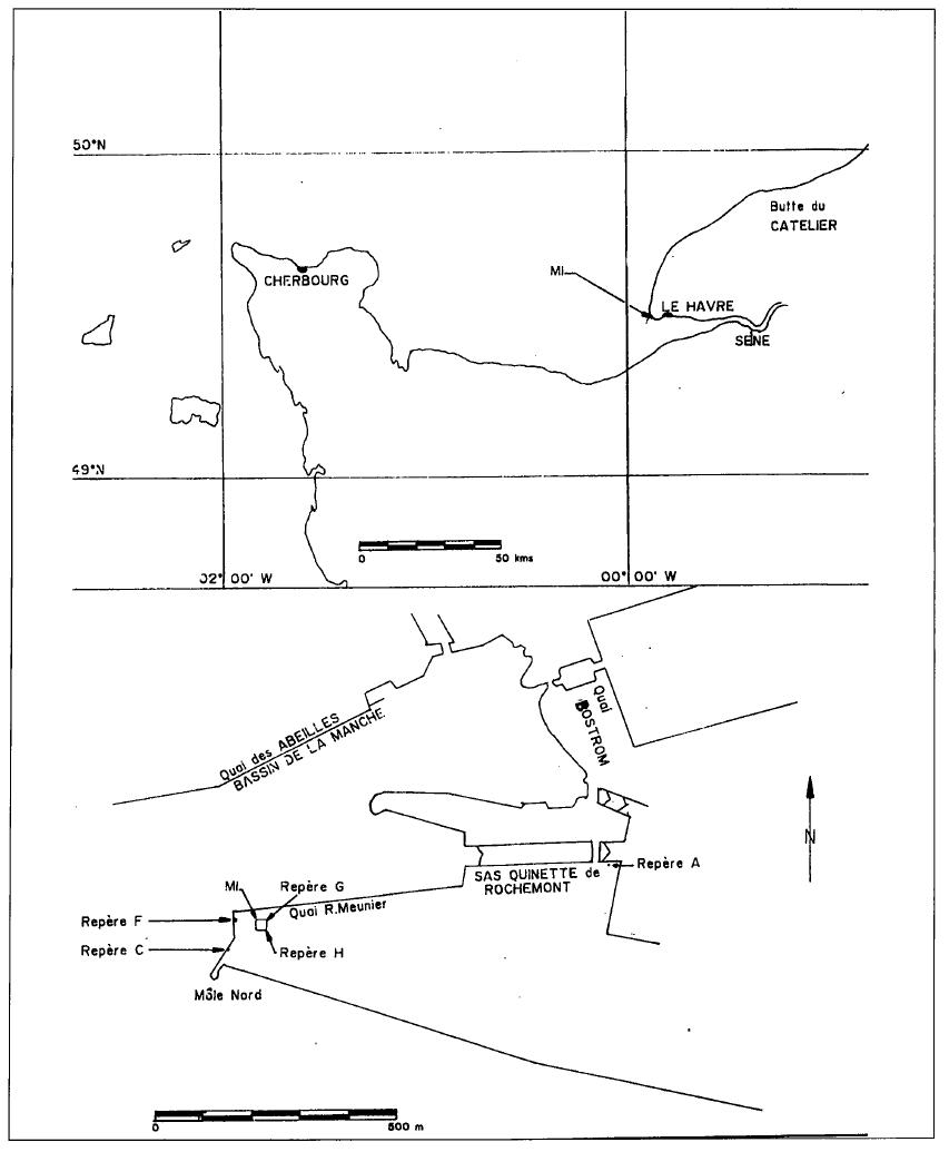
Benchmark positionning related to the tide gauge station

Benchmarks description table
Benchmarks vertical positionning diagram
Reference:
Leveling evolution
| Stand point | B | B | F | F | A | A | C | G | ||
|---|---|---|---|---|---|---|---|---|---|---|
| End point | F | G | G | C | G | C | G | H | ||
| Distance (m) | ---- | ---- | ---- | 87 | ---- | 822 | ---- | ---- | ||
| Height difference (m) | Campaign 4 | 2018-10-12 | --- | --- | --- | --- | --- | --- | --- | --- |
| Campaign 3 | 2013-10-15 | --- | --- | --- | --- | --- | --- | --- | --- | |
| Campaign 2 | 2005-05-18 | 0.3290 ± 0.001 | 0.6700 ± 0.001 | 0.3410 ± 0.001 | --- | 1.2020 ± 0.001 | --- | --- | --- | |
| Campaign 1 | 2005-02-15 | --- | --- | 0.3410 ± 0.001 | 0.1020 ± 0.001 | --- | 0.9630 ± 0.001 | 0.2390 ± 0.001 | 0.2070 ± 0.001 | |
| Height difference evolution graph |  |  |  |  |  |  |  |  | ||
Download leveling data
TIDE GAUGE LOCAL LEVELING NETWORK DATA OF STATION Le Havre - Vigie Ecluse François 1er
-----------------------------------------------------------------------------------------------------
Benchmark Lat. Long. Height Year of determination St.dev Distance_to_TG
10chr (°) 14chr (°) 14chr (m) 10chr 22chr (m)10chr (m) 10chr
-----------------------------------------------------------------------------------------------------
A 49.482611 0.116806 11.905 2018 0.00000 4190
B ---- ---- 12.176 2013 0.00100 ----
C 49.481139 0.105694 12.601 2018 0.00100 4970
F 49.481889 0.106056 12.501 2018 0.00100 4950
G ---- ---- 12.841 2018 0.00200 ----
H ---- ---- 13.048 2013 0.00100 ----
D ---- ---- 10.756 2018 0.00100 ----
I ---- ---- 11.571 2018 0.00100 ----
J ---- ---- 11.998 2018 0.00200 ----
K ---- ---- 13.049 2018 0.00200 ----
Co-located instruments
- Tide Gauge : LE_HAVRE (HAVRE)
- GPS : Le Havre - Vigie Ecluse François 1er (FRAN)


