
LEVELING OF SAINT-MALO
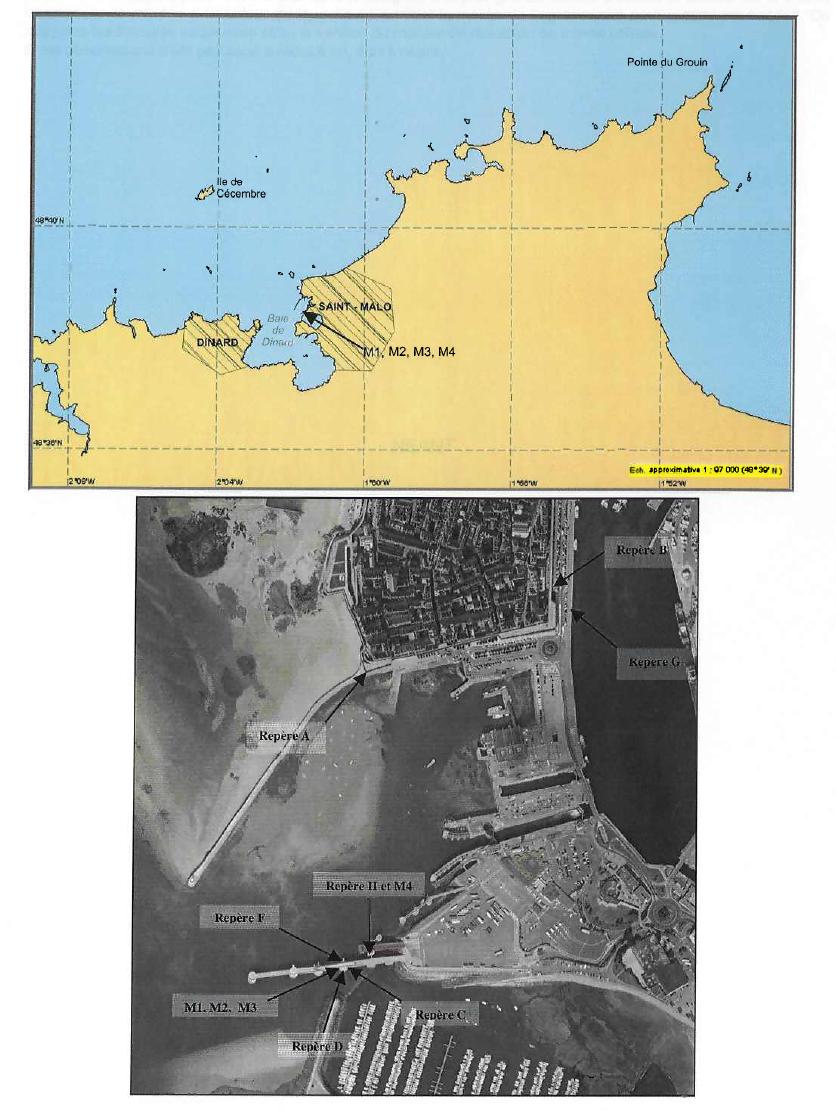
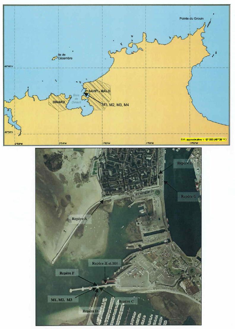
Benchmark positionning related to the tide gauge station


Benchmarks description table
Benchmarks vertical positionning diagram
Reference:
Leveling evolution
| Stand point | C | C | C | Z | X | X | Y bis | D | G | G | G | G | G | B | ||
|---|---|---|---|---|---|---|---|---|---|---|---|---|---|---|---|---|
| End point | W | H | F | Y bis | Y bis | W | SMTG_ARP | C | F | C | D | B | A | A | ||
| Distance (m) | ---- | ---- | ---- | ---- | ---- | ---- | ---- | ---- | ---- | ---- | ---- | ---- | ---- | 357 | ||
| Height difference (m) | Campaign 5 | 2019-01-22 | --- | --- | --- | --- | --- | --- | --- | --- | --- | --- | --- | --- | --- | --- |
| Campaign 4 | 2013-11-28 | --- | --- | --- | --- | --- | --- | --- | --- | --- | --- | --- | --- | --- | --- | |
| Campaign 3 | 2010-02-26 | 4.8761 ± 0.0005 | 1.8608 ± 0.0004 | --- | 4.6923 ± 0.0001 | 1.1674 ± 0.0002 | 0.0020 ± 0.0001 | 0.1198 ± 0.0002 | --- | --- | --- | --- | --- | --- | --- | |
| Campaign 2 | 2004-03-18 | --- | 1.8580 ± 0.001 | 0.5590 ± 0.001 | --- | --- | --- | --- | 0.2500 ± 0.001 | --- | --- | --- | --- | --- | --- | |
| Campaign 1 | 2001-06-01 | --- | --- | --- | --- | --- | --- | --- | --- | 1.5210 ± 0.001 | 0.9610 ± 0.001 | 0.7110 ± 0.001 | 0.6760 ± 0.001 | 0.9770 ± 0.001 | 0.3010 ± 0.001 | |
| Height difference evolution graph |  |  |  |  |  |  |  |  |  |  |  |  |  |  | ||
Download leveling data
TIDE GAUGE LOCAL LEVELING NETWORK DATA OF STATION Saint Malo
-----------------------------------------------------------------------------------------------------
Benchmark Lat. Long. Height Year of determination St.dev Distance_to_TG
10chr (°) 14chr (°) 14chr (m) 10chr 22chr (m)10chr (m) 10chr
-----------------------------------------------------------------------------------------------------
A 48.645667 -2.027889 14.485 2019 0.00000 510
B 48.647167 -2.023611 14.183 2019 0.00100 730
C ---- ---- 14.463 2019 0.00300 ----
D ---- ---- 14.215 2019 0.00100 ----
F ---- ---- 15.023 2019 0.00100 ----
G ---- ---- 13.506 2019 0.00200 ----
H ---- ---- 16.317 2019 0.00300 ----
W ---- ---- 19.557 2013 0.00000 ----
X ---- ---- 19.555 2013 0.00000 ----
Y ---- ---- ---- ---- ---- ----
Y bis ---- ---- 20.421 2019 0.00100 ----
Z ---- ---- 15.729 2019 0.00100 ----
SMTG_ARP ---- ---- 20.541 2019 0.00100 ----
J ---- ---- 15.808 2019 0.00300 ----
A_SS ---- ---- 16.019 2013 0.00000 ----
B_SS ---- ---- 13.003 2013 0.00000 ----
G bis ---- ---- 13.379 2019 0.00200 ----
I ---- ---- 19.332 2019 0.00300 ----
K ---- ---- 14.318 2019 0.00300 ----
N.QR-45 ---- ---- 14.580 2019 0.00200 ----
Co-located instruments
- Tide Gauge : SAINT-MALO (SMALO)
- GPS : Saint Malo (SMTG)
- GPS : Dinard Pleurtuit (DIPL)
- Tide Gauge : Saint Servan (SSERV)


