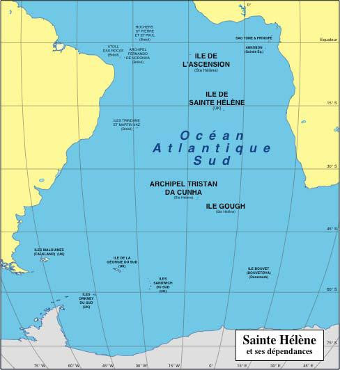
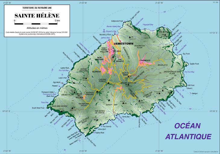
LEVELING OF SAINTE-HELENE
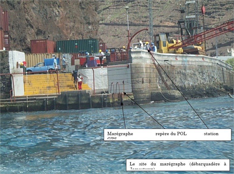
Benchmark positionning related to the tide gauge station
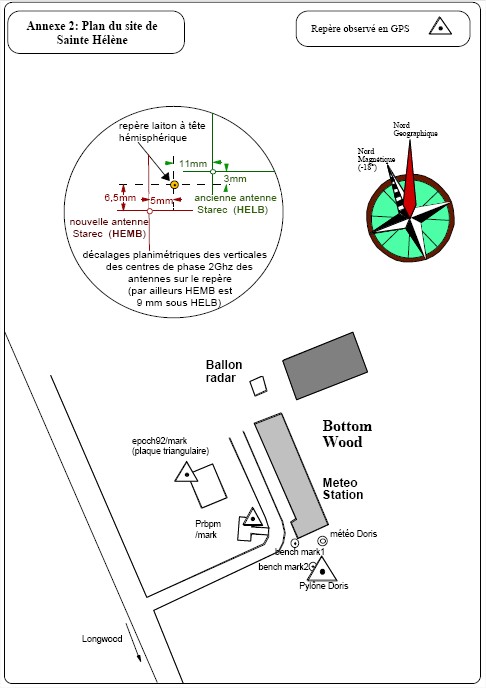
Benchmarks description table
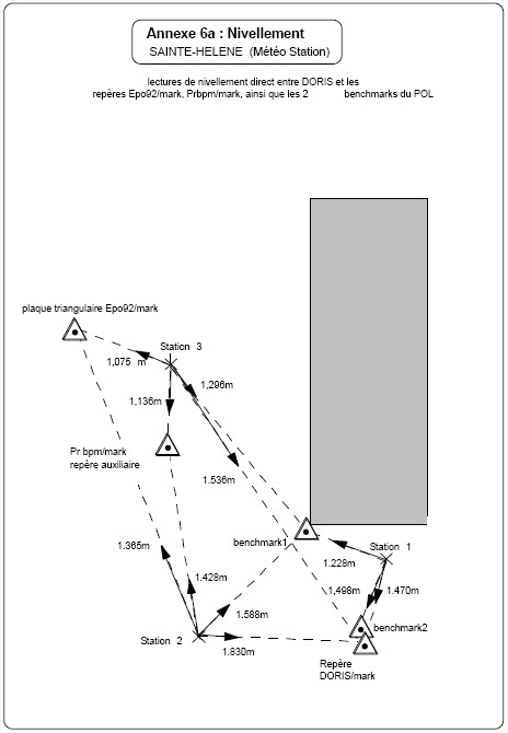
Benchmarks vertical positionning diagram
Reference:
Leveling evolution
| Stand point | GIG9 | GIG9 | GIG9 | GIG9 | GIG9 | Prbpm | Prbpm | Prbpm | Prbpm | Benchmark 1 | Benchmark 1 | DORIS/mark | DORIS/mark | DORIS/mark | DORIS/mark | POL | HELA | HELA | HELA | HELA | HELA | HELA | HELB | HELB | HELB | HELB | HELB | HEMB | HEMB | HEMB | HEMB | ||
|---|---|---|---|---|---|---|---|---|---|---|---|---|---|---|---|---|---|---|---|---|---|---|---|---|---|---|---|---|---|---|---|---|---|
| End point | Prbpm | Benchmark 1 | DORIS/mark | Benchmark 2 | shmg | Benchmark 1 | DORIS/mark | Benchmark 2 | shmg | DORIS/mark | Benchmark 2 | Benchmark 2 | GIG9 | Prbpm | shmg | shmg | HELB | HEMB | DORIS/mark | GIG9 | Prbpm | shmg | HEMB | DORIS/mark | GIG9 | Prbpm | shmg | DORIS/mark | GIG9 | Prbpm | shmg | ||
| Distance (m) | 19 | ---- | 38 | ---- | 5883 | ---- | 20 | ---- | 5901 | ---- | ---- | ---- | 38 | 20 | 5921 | ---- | 221 | 221 | 221 | 188 | 202 | 5714 | 0 | 0 | 38 | 20 | 5921 | 0 | 38 | 20 | 5921 | ||
| Height difference (m) | Campaign 1 | 2003-03-21 | -0.0630 ± 0.01 | 0.2230 ± 0.001 | 0.4650 ± 0.001 | 0.4610 ± 0.001 | -431.6980 ± 0.01 | 0.1600 ± 0.001 | 0.4020 ± 0.001 | 0.4000 ± 0.001 | -431.6350 ± 0.01 | 0.2420 ± 0.001 | 0.2700 ± 0.001 | -0.0280 ± 0.001 | 0.4640 ± 0.01 | 0.4010 ± 0.01 | -431.2340 ± 0.01 | 2.6900 ± 0.001 | -1.8770 ± 0.01 | -1.8860 ± 0.01 | -4.2820 ± 0.01 | -3.8180 ± 0.01 | -3.8810 ± 0.01 | -435.5160 ± 0.01 | -0.0090 ± 0.01 | -2.4050 ± 0.001 | -1.9410 ± 0.01 | -2.0040 ± 0.01 | -433.6390 ± 0.01 | -2.3960 ± 0.001 | -1.9320 ± 0.01 | -1.9950 ± 0.01 | -433.6300 ± 0.01 |
| Height difference evolution graph |  |  |  |  |  |  |  |  |  |  |  |  |  |  |  |  |  |  |  |  |  |  |  |  |  |  |  |  |  |  |  | ||
Download leveling data
TIDE GAUGE LOCAL LEVELING NETWORK DATA OF STATION Saint Helena
-----------------------------------------------------------------------------------------------------
Benchmark Lat. Long. Height Year of determination St.dev Distance_to_TG
10chr (°) 14chr (°) 14chr (m) 10chr 22chr (m)10chr (m) 10chr
-----------------------------------------------------------------------------------------------------
HELA -15.942223 -5.669423 446.133 2003 0.01100 230
HELB -15.942356 -5.667367 444.256 2003 0.01500 20
HEMB -15.942356 -5.667368 444.247 2003 0.01800 20
DORIS/mark-15.942356 -5.667368 441.851 2003 0.01800 20
GIG9 -15.942167 -5.667664 442.315 2003 0.02100 50
Prbpm -15.942283 -5.667535 442.252 2003 0.02300 40
shmg -15.920552 -5.717866 10.617 2003 0.00100 5930
Benchmark ---- ---- 442.412 2003 0.02300 ----
Benchmark ---- ---- 442.682 2003 0.02300 ----
POL ---- ---- 7.927 2003 0.00000 ----
Co-located instruments
- Doris : ST HELENA (HEMB)
- Tide Gauge : JAMESTOWN LANDING STEPS (SHELE)
- GPS : Saint Helena (STHL)
- Tide Gauge : Rupert's Bay (STHRB)
- GPS : Jameston (SHTA)
- GPS : Jamestown Hill (RTOW)
Photo album