
LEVELING OF POINTE-A-PITRE
Benchmark positionning related to the tide gauge station
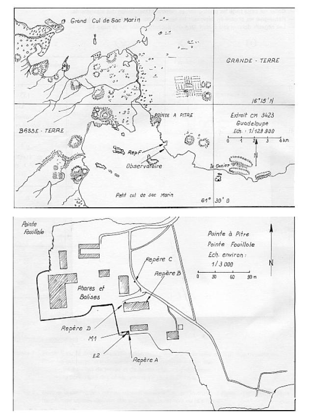
Benchmarks description table
Benchmarks vertical positionning diagram
Reference:
Leveling evolution
| Stand point | A | A | G | G | G | D | F | H | ||
|---|---|---|---|---|---|---|---|---|---|---|
| End point | G | I | D | I | H | C | C | C | ||
| Distance (m) | ---- | ---- | ---- | ---- | ---- | 49 | 262 | ---- | ||
| Height difference (m) | Campaign 2 | 2015-12-02 | --- | --- | --- | --- | --- | --- | --- | --- |
| Campaign 1 | 2005-10-26 | 0.0360 ± 0.001 | 0.0590 ± 0.001 | 0.6050 ± 0.001 | 0.0230 ± 0.001 | 1.2920 ± 0.001 | 0.9570 ± 0.001 | 0.4370 ± 0.001 | 0.2700 ± 0.001 | |
| Height difference evolution graph |  |  |  |  |  |  |  |  | ||
Download leveling data
TIDE GAUGE LOCAL LEVELING NETWORK DATA OF STATION LES ABYMES
-----------------------------------------------------------------------------------------------------
Benchmark Lat. Long. Height Year of determination St.dev Distance_to_TG
10chr (°) 14chr (°) 14chr (m) 10chr 22chr (m)10chr (m) 10chr
-----------------------------------------------------------------------------------------------------
C 16.225556 -61.531667 9.300 2015 0.00000 4090
A 16.224750 -61.532028 7.687 2015 0.00300 4180
B 16.225278 -61.531861 8.037 2015 0.00300 4120
D 16.225278 -61.532028 8.338 2015 0.00300 4130
F 16.227806 -61.530889 8.873 2015 0.00300 3830
G ---- ---- 7.724 2015 0.00300 ----
H ---- ---- 2.613 2005 0.00100 ----
I ---- ---- 7.745 2015 0.00300 ----
K 16.224396 -61.531663 7.766 2015 0.00300 4220
J 16.224396 -61.531663 10.831 2015 0.00300 4220
L ---- ---- 7.381 2015 0.00300 ----
IGN GO-11 ---- ---- 8.498 2015 0.00300 ----
Co-located instruments
- Tide Gauge : POINTE-A-PITRE (PITRE)
- GPS : LES ABYMES (ABMF)
- GPS : Fort Fleur d'Epée (FFE0)
- GPS : POINTE-A-PITRE (PPTG)


