
FORT-DE-FRANCE
Contributing agency

Station summaryFFT2


| IGS-type acronym : | FFT2 |
| Latitude : | 14.60152680 |
| Longitude : | -61.06336657 |
| Installed date : | 2015-04-12 |
| Decommissioned date : | |
| Country : | FRANCE |
| City: | FORT-DE-FRANCE |
| Station status : | active (green) |
| Distance to Tide Gauge (m) : | 1 |
| Domes Nr.: | 97201M007 |
| Station operator: | (LIENSs - OASU) - LIENSs - OASU |
| IGS-like station form : |
GPS position times seriesFFT2
(Reference epoch: )
| M | Material change or malfunction |
| E | Earthquake |
| RF | Reference Frame change |
| U | Unknown |
| NA | Not available |
| Position discontinuity | |
| Velocity discontinuity |
Data available at SONELFFT2
Quality plots on RINEX filesFFT2
 |
 |
Plots generated using software developed with the EPN team at ROB |
| Observations & tracking performance | Satellite tracking |
 (this operation may take 20 to 45s)
The satellite tracking graph has been calculated for all stations for the first day of each month. If you wish to have a graph for another date, choose the 'Calculate a specific date' option.
Co-located instrumentsFFT2
- Tide gauge : FORT-DE-FRANCE (FOR2F)
- GPS : LE LAMENTIN (LMMF)
- GPS : FORT-DE-FRANCE (FFTG)
- Doris : LE LAMENTIN (LAOB)
Leveling & DatumsFFT2
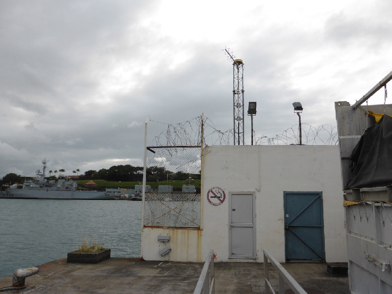
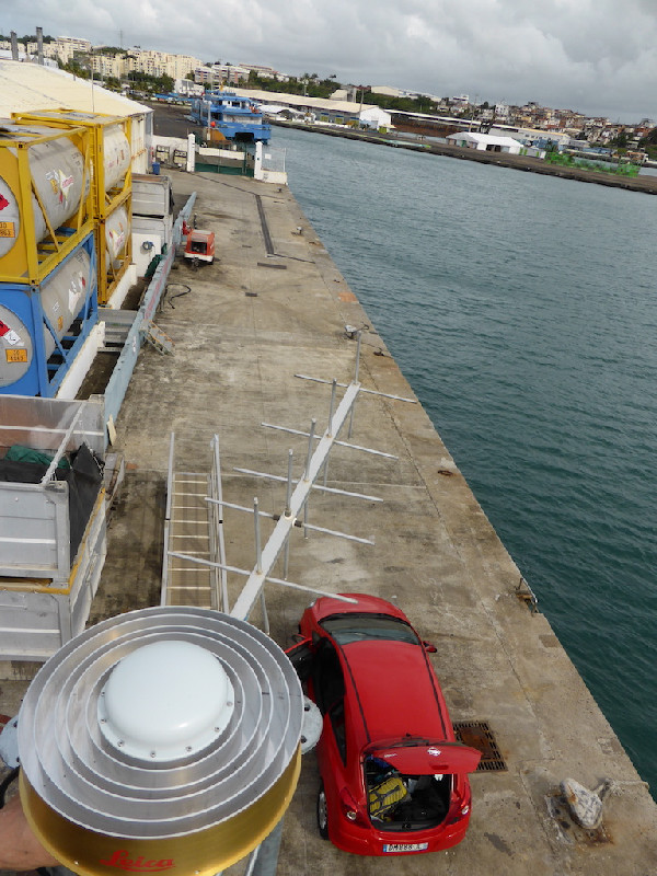
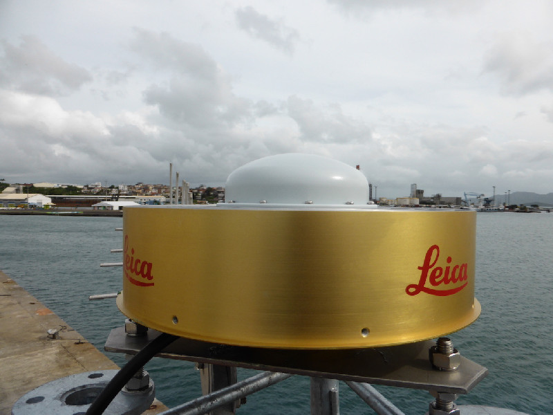
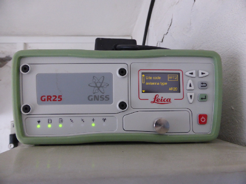
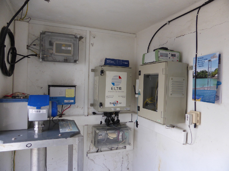
Photo albumFFT2

BibliographyFFT2
If you have a relevant reference to suggest, please send-us an e-mail : sonel@sonel.org-
 Gravalon, Seoane et al., 2021. The impact of barometric variations on the sea level in coastal areas using GNSS reflectometry. IGARSS Conference.
-
Gravalon, Seoane et al., 2022. Determination of weather-induced short-term sea level variations by GNSS reflectometry. Remote Sensing of Environment.


Log bookFFT2
[RGP Mail] 2019-11-27 (25/05/2022)
Following a highly accurate recalculation and thanks to the arrival of many partner stations in the West Indies, the RGAF09 coordinates of all stations in the West Indies have been updated to ensure a greater coherence of the entire area.
This includes Martinique (LMMF and FFT2), Guadeloupe (ABMF, PPTG, DEHA, LDIS and MAGT), Saint-Martin (STMT) and Saint-Barthélemy (GSTV) stations.
Some TERIA stations in Guadeloupe have also been renamed, using the acronyms of the IPGP stations to which they follow.
The changes are as follows:
ANBE -> ABD0
CABE -> CBE0
LGOS -> FFE0
SAIN -> FNA0
STCL -> HOUE
STFR -> ASF0
[RGP Mail] 2017-12-27 (25/05/2022)
The dataflow for station FFT2 (Fort-de-France) stopped at session 346f. We don't know the reason.
2015/12/03 : GNSS station "FFT2" installation (25/05/2022)
Mission carried out by Thomas Donal (IGN) and Etienne Poirier (ULR) from 01 to 03 December 2015: Since the FFTG station has been down for a long time, it was decided to stop this station and replace it. The mast was kept and extended by 1 meter and the top plate was changed by a 5 mm 316L stainless steel plate. The Yagi antenna (for the tide gauge) has been lowered slightly to avoid disturbances of GNSS signals. We installed a Leica GR25 GNSS receiver and a Leica AR20 antenna and this assembly is the FFT2 station. FFT2 replaces and cancels FFTG.


