
BREST
Station summary


| Responsible organization: | link to REFMAR web page |
| Latitude : | 48.38285000 |
| Longitude : | -4.49483800 |
| Start date: | |
| End date: | |
| GLOSS Nr.: | 242 |
| Country: | FRANCE |
| City: | BREST |
| Station state: | VERT |
Mean sea level
Daily means
Monthly means
Annual means
Calculating the mean sea levels
Links to data sources

Comparison with satellite altimetry data
- Link to Sea Level Differences (Satellite altimetry minus tide gauge data).
Co-located instrumentsBREST
- GPS : Brest (BRST)
- GPS : Guipavas (GUIP)
- GPS : Bourg Blanc (BGBC)
Leveling & DatumsBREST
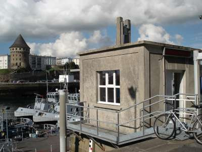
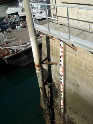
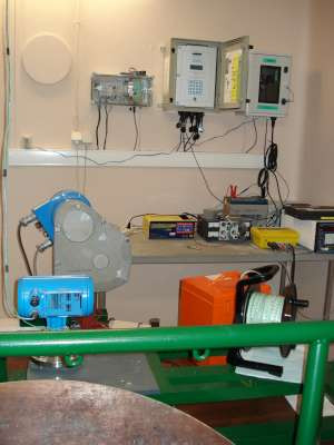
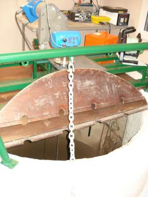
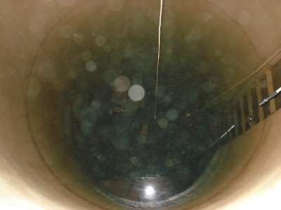
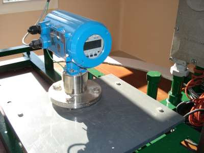
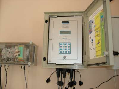
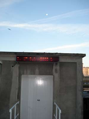
Photo albumBREST
BibliographyBREST
If you have a relevant reference to suggest, please send-us an e-mail : sonel@sonel.org-
 Chenal, 2025. Observational uncertainties on past and future sea level rise for Marseille and Brest tide gauges. Comptes Rendus. Géoscience.


-
Dodet, Bertin et al., 2019. Characterization of Sea-level Variations Along the Metropolitan Coasts of France: Waves, Tides, Storm Surges and Long-term Changes.
-
Douglas, 2008. Concerning Evidence for Fingerprints of Glacial Melting. Journal of Coastal Research.
-
Miller, Douglas, 2007. Gyre-scale atmospheric pressure variations and their relation to 19th
and 20th century sea level rise. Geophysical Research Letters.
-
Poitevin, Wöppelmann et al., 2019. Vertical land motion and relative sea level changes along the coastline of Brest (France) from combined space-borne geodetic methods. Remote Sensing of Environment.
-
Pouvreau, 2006. Evolution of the tidal semi-diurnal constituent M2 at Brest from 1846 to 2005. C. R. Geoscience.
-
Rossi, Horton et al., 2011. The application of foraminifera to reconstruct the rate of 20th century sea level rise, Morbihan Golfe, Brittany, France. Quaternary Research.
-
Woodworth, Pouvreau et al., 2010. The gyre-scale circulation of the North Atlantic and sea level at Brest. Ocean Science.
-
Woodworth, 1999. High waters at Liverpool since 1768: the UK's longest sea level record. Geophysical Research Letters.
-
Woppelmann, Pouvreau et al., 2006. Brest sea level record: a time series construction back to the early eighteenth century. Ocean Dynamics.
-
Woppelmann, Pouvreau et al., 2008. Tide gauge datum continuity at Brest since 1711: France’s longest sea level
record. Geophysical Research Letters.
Logbook
2020-10-13 (31/05/2022)
Intervention by the SHOM to change the acquisition central of the tide gauge. Before it was an Elta system, now it is a Campbell. Also, installation of the meteorological sensor METSENS500.Le 16/01/2016 (16/01/2017)
Mise à jour et corrections sur toutes les campagnes de nivellement de la station BREST. Insertion de la distinction entre le ZH avant et après 1996.Restent à rentrer les campagnes de nivellement 1889, 1938, 1962, 1973, 1985, et certaines dénivelées de 1996 pour les repères iGN NO-57 et NO-56.
E.Poirier
Le 16/02/2010 (07/04/2010)
Relance du MCN. Archivage des données.Le 02/12/2009 (07/04/2010)
Problème au marégraphe. Manque données du 02/12/2009 au 03/12/2009.Le 05/02/1993 (06/04/2010)
Un premier marégraphe côtier numérique (MCN) est installé à Brest le 05/02/1993: capteur ultrason IEE et centrale d'acquisition MORS HT200.Le 29/05/2000 (06/04/2010)
Mise en place d'un afficheur indiquant la hauteur d'eau enregistrée par le marégraphe au dessus de la porte du marégraphe.Le 01/10/2000 (06/04/2010)
Installation d'un marégraphe radar: capteur BM70 et d'une centrale d'acquisition Elta. A noter que le marégraphe ultrason continue à enregistrer.Le 26/11/2002 (06/04/2010)
Le capteur radar BM70 est remplacé par un capteur BM100 (toujours Krohne).Le 26/11/2009 (11/12/2009)
Relance du MCN. Archivage des données à 10min et HH.Le 22/10/2009 (09/11/2009)
Suite à un test de Van de Cateele réalisé semaine 43, de nouveaux coefficients a1 et b1 de correction ont été calculés et entrés dans la centrale du MCN de Brest.Le 26/06/2008 (23/03/2009)
Remplacement du prototype par une nouvelle centrale ELTA.History of this station
Le lecteur intéressé trouvera une histoire assez complète de cette station dans la thèse de doctorat de N. Pouvreau (en ligne dans la section documentation de SONEL). Les premières mesures remontent à 1679, réalisées par les astronomes Jean Picard et Philippe de la Hire. Le premier appareil à enregistrement automatique (marégraphe) date de 1846, installé par Rémi Chazallon. Il sera opérationnel sur près de 100 ans jusque 1944 où il sera détruit lors des bombardements de la ville. Une reconstruction de la série temporelle a été réalisée avec succès en 2006, couvrant près de 300 ans et faisant de Brest la série de mesures du niveau de la mer la plus longue en France, voire dans le monde (Voir l'article publié en 2008 dans la revue américaine Geophysical Research Letters).


