
KING EDWARD POINT
Contributing agency

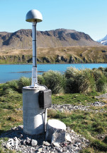
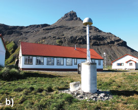
Station summaryKRSA


| IGS-type acronym : | KRSA00SGS |
| Latitude : | -54.28372900 |
| Longitude : | -36.49496200 |
| Installed date : | |
| Decommissioned date : | |
| Country : | UK |
| City: | KING EDWARD POINT |
| Station status : | Survey (blue) |
| Distance to Tide Gauge (m) : | 529 |
| Domes Nr.: | 42702M001 |
| Station operator: |
Teferle F. N
|
| IGS-like station form : |
Co-located instrumentsKRSA
- Tide gauge : KING EDWARD POINT (KEPNT)
- GPS : KEPA (KEPA)
Photo albumKRSA
BibliographyKRSA
If you have a relevant reference to suggest, please send-us an e-mail : sonel@sonel.org-
 Teferle, Hunegnaw et al., 2015. The King Edward Point Geodetic Observatory, South Georgia, South Atlantic Ocean.


