Home
Presentation
Aims and rationale
Origin of SONEL
Scientific & technical partners
Observations
Tide gauges
GNSS
Stability of the datums
Doris
Absolute gravimetry
Station management
Products (demonstrative)
Sea level trends
Vertical land movements
Horizontal land movements
Waves
Web Services
Programmes (GLOSS)
Global Sea Level Observing System (GLOSS)
PSMSL
TIGA
CGPS@TG
Users
Applications
Publications
Statistics
Documentation
Partners & Contacts
GNSS Data Providers
SONEL contacts
Station manager only
or
ULR authentication
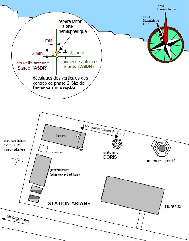
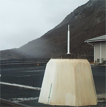
ASCENSION ISLAND
Home
Observations
DORIS
Station summary
Showing all stations within 1000 km of the observed station
Active station
No data for 30 days
Decommissioned
No observations in SONEL (Survey)
Not co-located with observed station
Showing all stations within 1000 km of the observed station
Available data / Station OK
Available data / Problem(s) detected
Does not work
No longer exists
Foreign partner management
Not co-located with observed station
Showing all stations within 1000 km of the observed station
Co-located with observed station
Not co-located with observed station
More informations on each symbol.
GPS
Tide Gauge
DORIS
Responsible organization:
Institut National de l'Information Géographique et Forestière
Latitude :
-7.89288689
Longitude :
-14.38577520
Start date :
2010-07-21
End date :
Country :
UK
City :
ASCENSION ISLAND
Sensor type :
Soon...
Station state:
HORS SONEL
Link to DORIS data (international service IDS)
http://ids-doris.org/network/sitelogs/station.html?code=ASCENSION
Co-located instruments
ASEB
GPS :
Ascension Island
(ASC1)
Tide gauge :
ENGLISH BAY
(ASCEN)
GPS :
ASCENSION
(ASCG)
Photo album
ASEB
Mentions légales
|
Data policy
|
SONEL contacts