
RIKITEA, GAMBIER
Contributing agency


Station summaryRKTG


| IGS-type acronym : | RKTG |
| Latitude : | -23.11780000 |
| Longitude : | -134.96900000 |
| Installed date : | 2012-05-14 |
| Decommissioned date : | |
| Country : | FRANCE |
| City: | RIKITEA, GAMBIER |
| Station status : | No data for 30 days (orange) |
| Distance to Tide Gauge (m) : | 2 |
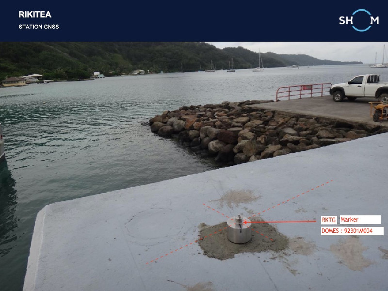
| Domes Nr.: | 92301M004 |
| Station operator: | (SHOM) - Service Hydrographique et Océanographique de la Marine |
| IGS-like station form : |
GPS position times seriesRKTG
Position
(Reference epoch: )
(Reference epoch: )
Offsets (mm)
| M | Material change or malfunction |
| E | Earthquake |
| RF | Reference Frame change |
| U | Unknown |
| NA | Not available |
| Position discontinuity | |
| Velocity discontinuity |
Data available at SONELRKTG
Quality plots on RINEX filesRKTG
 |
 |
Plots generated using software developed with the EPN team at ROB |
| Observations & tracking performance | Satellite tracking |
 (this operation may take 20 to 45s)
The satellite tracking graph has been calculated for all stations for the first day of each month. If you wish to have a graph for another date, choose the 'Calculate a specific date' option.
Co-located instrumentsRKTG
Leveling & DatumsRKTG
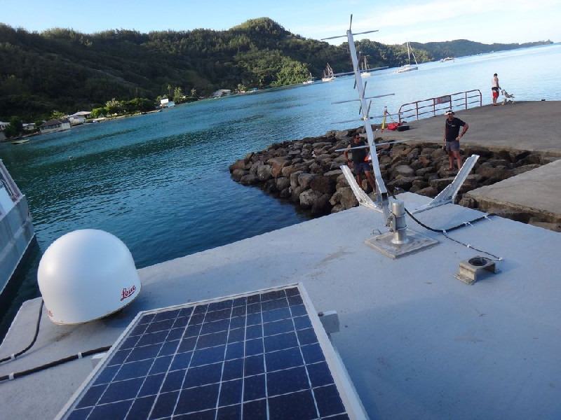
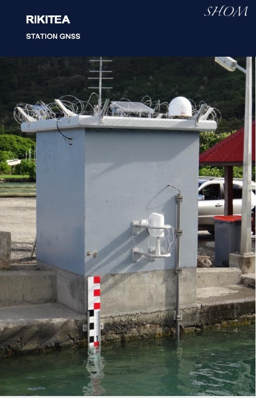
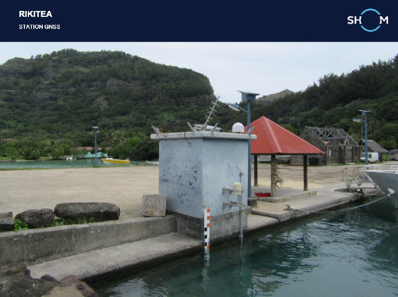
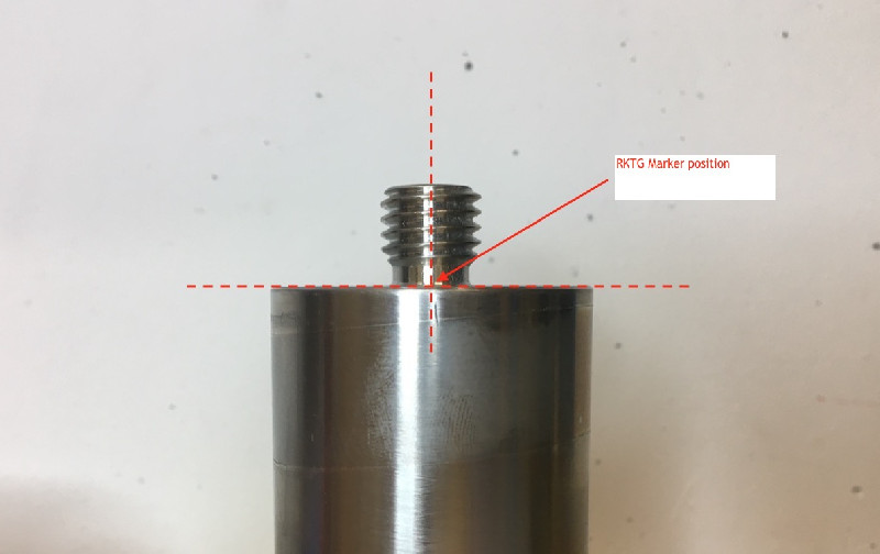
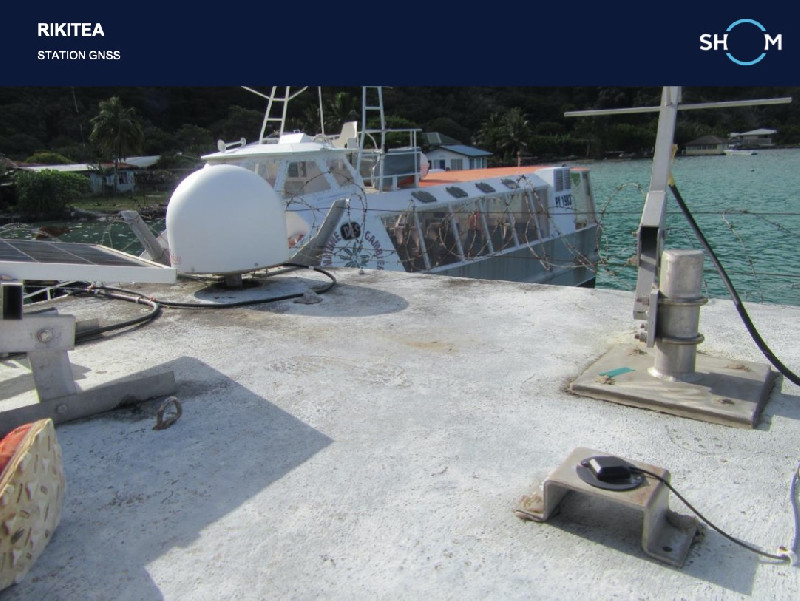
Photo albumRKTG

BibliographyRKTG
If you have a relevant reference to suggest, please send-us an e-mail : sonel@sonel.org-
 Xianjie-Li, Jean-Pierre-Barriot et al., 2023. Monitoring absolute vertical land motions and absolute sea-level changes from GPS and tide gauges data over French Polynesia. Geodesy and Geodynamics.


History of the stationRKTG
Station installée par le GOP-Shom le 14 mai 2012.
Log bookRKTG
2020-08-11 (11/08/2020)
A DOMES number has been obtained for RKTG GNSS station. The first sitelog is now availbale at sonel.org.
However, for the momeent we cannot find the missing GNSS data from 2013 to now.
E.Poirier.


