
POINTE-A-PITRE
Contributing agency

Station summaryPPTG


| IGS-type acronym : | PPTG00GLP |
| Latitude : | 16.22439580 |
| Longitude : | -61.53166299 |
| Installed date : | 2015-11-27 |
| Decommissioned date : | |
| Country : | FRANCE |
| City: | POINTE-A-PITRE |
| Station status : | active (green) |
| Distance to Tide Gauge (m) : | 2 |
| Domes Nr.: | 97108M001 |
| Station operator: | (LIENSs-OASU) - LIENSs - OASU |
| IGS-like station form : |
GPS position times seriesPPTG
(Reference epoch: )
| M | Material change or malfunction |
| E | Earthquake |
| RF | Reference Frame change |
| U | Unknown |
| NA | Not available |
| Position discontinuity | |
| Velocity discontinuity |
Data available at SONELPPTG
Quality plots on RINEX filesPPTG
 |
 |
Plots generated using software developed with the EPN team at ROB |
| Observations & tracking performance | Satellite tracking |
 (this operation may take 20 to 45s)
The satellite tracking graph has been calculated for all stations for the first day of each month. If you wish to have a graph for another date, choose the 'Calculate a specific date' option.
Co-located instrumentsPPTG
- Tide gauge : POINTE-A-PITRE (PITRE)
- GPS : LES ABYMES (ABMF)
- GPS : Fort Fleur d'Epée (FFE0)
Leveling & DatumsPPTG
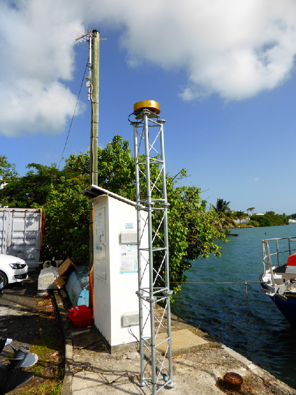
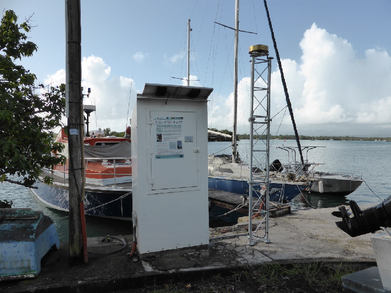
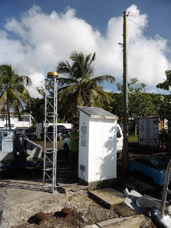
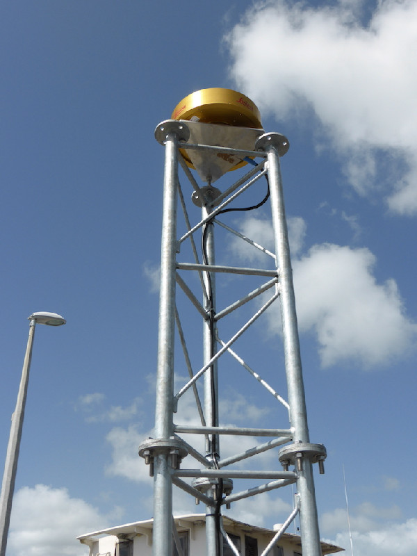
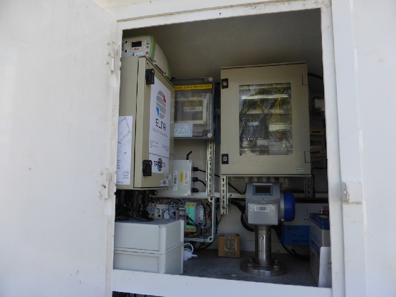
Photo albumPPTG
BibliographyPPTG
If you have a relevant reference to suggest, please send-us an e-mail : sonel@sonel.org-
 Le-Cozannet, Idier et al., 2021. Timescales of emergence of chronic flooding in the major economic center of Guadeloupe. Natural Hazards and Earth System Sciences.


Log bookPPTG
[RGPmail] 2025-06-10 No data (03/07/2025)
The station has stopped sending data sincer June 7. Data are available since June 30. After discussion with the local partner (Meteo France), the station was not powered following electrical maintenance by the maritime affairs department.
No data between the June 7 and June 30
[RGPmail] 2025-06-10 No data (03/07/2025)
The station has stopped sending data sincer June 7. Data are available since June 30. After discussion with the local partner (Meteo France), the station was not powered following electrical maintenance by the maritime affairs department.
[RGPmail] 2024-10-25 (13/11/2024)
No data and no communication with the station. Local MeteoFrance is investigating the problem.
There was no electricity in Guadeloupe after a black-out. The station was OFF.
November 8, 2024 : People from MeteoFrance detected that the 24v circuit breaker was faulty (circuit breaker does not stay on). That's why they changed the power supply cable circuit. The station is working but not sending data.
November 12, 2024 : The people at MeteoFrance have reset the circuit breaker. There is a suspicted electrical problem with the circuit breaker and power supply to the station. The station is operating and sending data.
[RGPmail] 2024-04-24 (04/11/2024)
No data and no communication with the station.
After contacting Gustave GEMISE of MétéoFrance,the station look normal:
- electricity available
- Battery power : normal
- 4G Transmitter : OK
May 13, 2024 : They reboot the station.
May 14 , 2024 : the station is operating again. No data loss!
[RGPmail] - 2019-11-27 (18/03/2020)
Suite à un recalcul de grande précision et grâce à l'arrivée de nombreuses stations partenaires aux Antilles, les coordonnées RGAF09 de l’ensemble des stations des Antilles ont été mises à jour pour assurer une plus grande cohérence de l'ensemble de la zone.
Sont donc concernés : La Martinique (LMMF et FFT2), la Guadeloupe (ABMF, PPTG, DEHA, LDIS et MAGT), Saint-Martin (STMT) et Saint-Barthélemy (GSTV).
Certaines stations TERIA de la Guadeloupe ont de plus été renommées, reprenant ainsi les acronymes des stations IPGP auxquelles elles succèdent.
Les changements s’effectuent comme suit :
ANBE -> ABD0
CABE -> CBE0
LGOS -> FFE0
SAIN -> FNA0
STCL -> HOUE
STFR -> ASF0
[RGPmail] - 2018-03-23 (23/03/2018)
The dataflow for station PPTG (971, Guadeloupe) stopped at session 068n. The delay of recovery is unknown.
Les données des stations PPTG (971, Guadeloupe) et STPM (975, Saint-Pierre et Miquelon) ne nous parviennent plus depuis les sessions : 068n et 079l respectivement.
Nous ne connaissons pas le délai de retour à la normale.
Installation de la station GNSS (PPTG) colocalisée au marégraphe de Pointe-a-Pitre (PITRE) (11/12/2015)
Du 24 au 27 novembre 2015, le SHOM, l'IGN et l'ULR sont intervenus sur le site du marégraphe de Pointe-à-Pitre.
Le SHOM (Ronan LeGall et Paul Velu) s'est chargé de la maintenance du marégraphe PITRE et du nivellement des repères géodésiques de l'observatoire de marée. Thomas Donal (IGN) et Etienne Poirier (ULR) ont quant à eux installé une station GNSS (PPTG) à 2 mètres de distance du marégraphe.


