
CHURCHILL
Contributing agency

Station summaryCHUR


| IGS-type acronym : | CHUR00CAN |
| Latitude : | 58.75907788 |
| Longitude : | -94.08872705 |
| Installed date : | 1993-04-24 |
| Decommissioned date : | |
| Country : | CANADA |
| City: | CHURCHILL |
| Station status : | active (green) |
| Distance to Tide Gauge (m) : | 6000 |
| Domes Nr.: | 40128M002 |
| Station operator: | (NRCan) - National Resources Canada |
| IGS-like station form : |
GPS position times seriesCHUR
(Reference epoch: )
| M | Material change or malfunction |
| E | Earthquake |
| RF | Reference Frame change |
| U | Unknown |
| NA | Not available |
| Position discontinuity | |
| Velocity discontinuity |
Data available at SONELCHUR
Quality plots on RINEX filesCHUR
 |
 |
Plots generated using software developed with the EPN team at ROB |
| Observations & tracking performance | Satellite tracking |
 (this operation may take 20 to 45s)
The satellite tracking graph has been calculated for all stations for the first day of each month. If you wish to have a graph for another date, choose the 'Calculate a specific date' option.
Comparison with satellite altimetry data
- Link to Sea Level Differences (Satellite altimetry minus tide gauge data).
Co-located instrumentsCHUR
- Tide gauge : CHURCHILL (CHUTG)
Leveling & DatumsCHUR
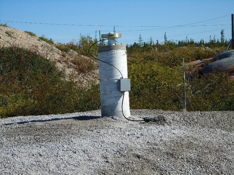
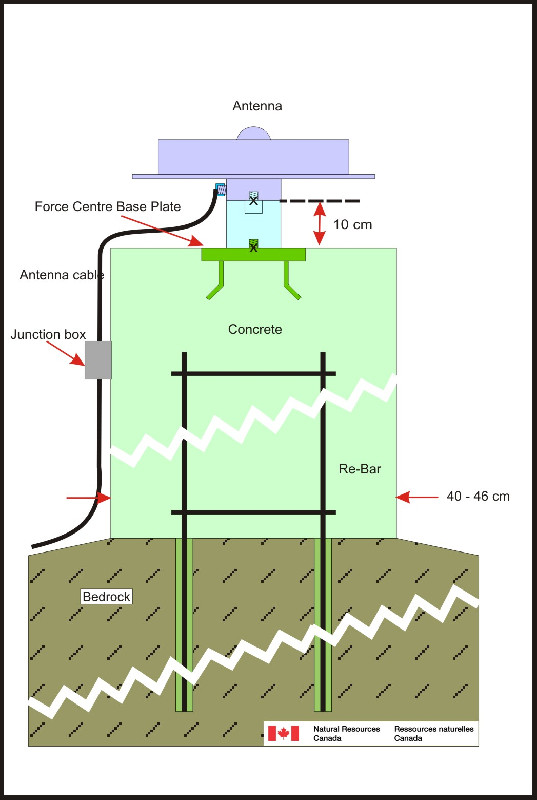
Photo albumCHUR

Log bookCHUR
[IGSSTATION-7597] - 2019-03-20 (26/04/2019)
The TPS NET-G3A receiver at CHUR has been updated to firmware version 4.7 Nov,23,2017 p6 on 19 March 2019 at 16:50 utc. An updated site log has been submitted to the IGS.
[IGSSTATION-6721] - 2016-07-20 (19/08/2016)
Today at approximately 18ut station CHUR will be set to track on an external Rubidium frequency standard. There will be a data outage while this change is performed.
[IGSSTATION-6088] - 2015-02-06 (09/02/2015)
On Wednesday, February 4, 2015 at ~15:25ut the receiver at station CHUR was switched to track with its internal clock. An updated Site Log will be submitted to IGSCB shortly.
Intermittent tracking issues caused by the external clock began on Saturday, January 31, 2015 at ~23:30ut and continued until Wednesday, February 4, 2015 at ~15:25ut.


