
SASSNITZ
Contributing agency

Station summarySASS


| IGS-type acronym : | SASS00DEU |
| Latitude : | 54.51359025 |
| Longitude : | 13.64329170 |
| Installed date : | 2002-12-12 |
| Decommissioned date : | 2019-02-28 |
| Country : | GERMANY |
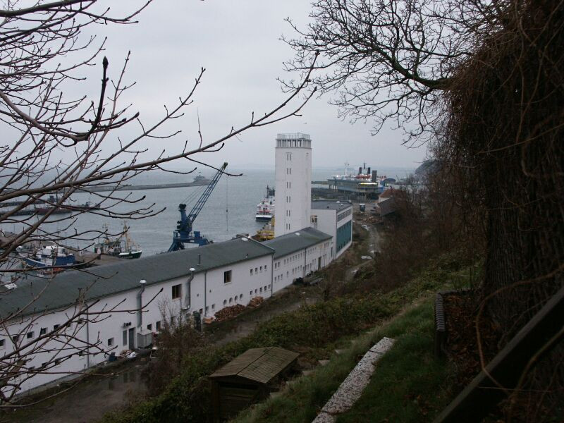
| City: | SASSNITZ ISLAND OF RUEGEN |
| Station status : | Decommissioned (white and red cross) |
| Distance to Tide Gauge (m) : | 291 |
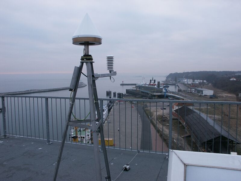
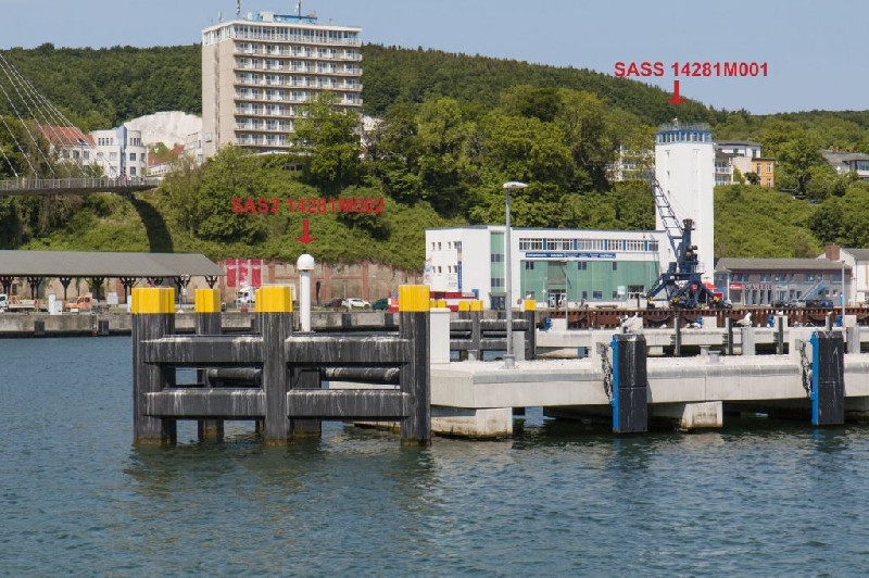
| Domes Nr.: | 14281M001 |
| Station operator: | (BKG) - Bundesamt für Kartographie und Geodäsie |
| IGS-like station form : |
GPS position times seriesSASS
Position
(Reference epoch: )
(Reference epoch: )
Offsets (mm)
| M | Material change or malfunction |
| E | Earthquake |
| RF | Reference Frame change |
| U | Unknown |
| NA | Not available |
| Position discontinuity | |
| Velocity discontinuity |
Data available at SONELSASS
Quality plots on RINEX filesSASS
 |
 |
Plots generated using software developed with the EPN team at ROB |
| Observations & tracking performance | Satellite tracking |
 (this operation may take 20 to 45s)
The satellite tracking graph has been calculated for all stations for the first day of each month. If you wish to have a graph for another date, choose the 'Calculate a specific date' option.
Comparison with satellite altimetry data
- Link to Sea Level Differences (Satellite altimetry minus tide gauge data).
Leveling & DatumsSASS
Photo albumSASS
BibliographySASS
If you have a relevant reference to suggest, please send-us an e-mail : sonel@sonel.org-
 Malgorzata-Stramska, Natalia-Chudziak, 2013. Recent multiyear trends in the Baltic Sea level. Oceanologia.


-
Rezvani, Watson et al., 2021. Estimating Vertical Land Motion and Residual Altimeter Systematic Errors Using a Kalman-Based Approach. Journal of Geophysical Research: Oceans.
Log bookSASS
[EUREFmail-09785] - 2019-03-19 (26/04/2019)
The BKG Station SASS 14281M001 was removed on 2019-02-28 due to the planned rebuild of the tower, there SASS was mounted.
Alternative BKG is operating a second station SAS2 14281M002 in the harbour of Sassnitz (EPN Station). Data are available at BKG Datacenter at project EUREF.


