
DUNKERQUE
Contributing agency


Station summaryDUNQ


| IGS-type acronym : | DUNQ00FRA |
| Latitude : | 51.04809952 |
| Longitude : | 2.36664009 |
| Installed date : | 2013-09-19 |
| Decommissioned date : | |
| Country : | FRANCE |
| City: | DUNKERQUE |
| Station status : | active (green) |
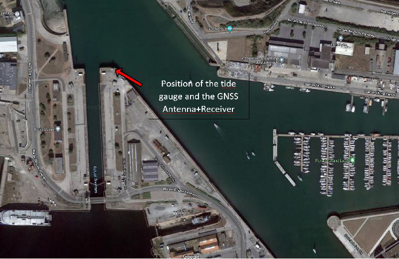
| Distance to Tide Gauge (m) : | 2 |
| Domes Nr.: | 19670M001 |
| Station operator: | (RENAG) - Réseau National GPS permanent (LIENSs-OASU) - LIENSs - OASU |
| IGS-like station form : |
GPS position times seriesDUNQ
(Reference epoch: )
| M | Material change or malfunction |
| E | Earthquake |
| RF | Reference Frame change |
| U | Unknown |
| NA | Not available |
| Position discontinuity | |
| Velocity discontinuity |
Data available at SONELDUNQ
Quality plots on RINEX filesDUNQ
 |
 |
Plots generated using software developed with the EPN team at ROB |
| Observations & tracking performance | Satellite tracking |
 (this operation may take 20 to 45s)
The satellite tracking graph has been calculated for all stations for the first day of each month. If you wish to have a graph for another date, choose the 'Calculate a specific date' option.
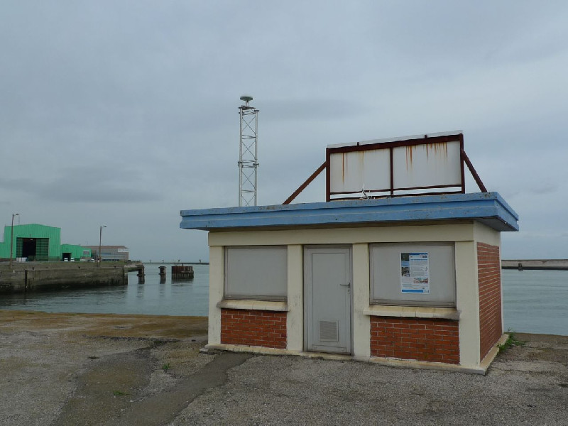
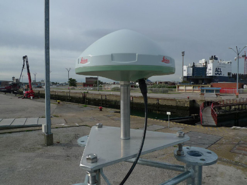
Co-located instrumentsDUNQ
- Tide gauge : DUNKERQUE (DUNKE)
- GPS : Coudekerque-Branche (COUD)
- GPS : Dunkerque Grand Littoral Géomatique (DGLG)
Leveling & DatumsDUNQ
Photo albumDUNQ
BibliographyDUNQ
If you have a relevant reference to suggest, please send-us an e-mail : sonel@sonel.org-
 Coulomb, 2014. Travaux réalisés en métropole en 2013 dans le cadre de la convention SONEL.
-
Dodet, Bertin et al., 2019. Characterization of Sea-level Variations Along the Metropolitan Coasts of France: Waves, Tides, Storm Surges and Long-term Changes.


Log bookDUNQ
2021-10-12 (23/05/2022)
Intervention by the SHOM to change the acquisition central of the tide gauge. Before it was an Elta system, now it is a Campbell. Also, installation of the meteorological sensor and the camera
2021-11-26 (23/05/2022)
T.Garmond, T.Donal and V. Kerebel went to Dunkerque to level all the instruments and the benchmarks close to the tide gauge GNSS installation.
Also, the IP adress of the GNSS receiver needed to be change so that it be linked with the tide gauge network.
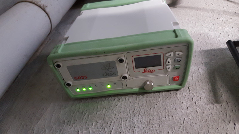
Update of the firmware receiver (23/05/2022)
The 06th of December, the Leica GR25 firmware has been updated to the V4.31 version.
An altimetric control has been done.
Intervention by T. Willaert (23/05/2022)
The 10th of July, T. Willaert, surveyor at the Dunkerque harbour went to inspect the Leica GR25 receiver. He looks at the LEDs, the c) and f) (concerning the downloadind the data) were red so the receiver did not download the data. He restarted the receiver. Then, all LEDs return to their green colour. (E. Poirier)
Inspection of DUNQ by T. Willaert (23/05/2022)
T. Willaert, surveyor at the Dunkerque harbour went to inspect the Leica GR25 receiver. He looks at the LEDs and restart the receiver. All looks fine now.
Data transmission failure since day 133/2017, including the 13th may of 2017 (23/05/2022)
On June 20, 2017, an email received from Pierre Touche from the RGP at the IGN, informed us that no data has been received from the DUNQ station since day 133/2017, that is to say on May 13, 2017 inclusive. Etienne Poirier contacted Thomas Donal at the IGN then David Jennquin and Thierry Willaert, surveyor at the port of Dunkerque. A restart procedure is sent to them to restart the GR25.
2020-07-01 - DUNQ station repaired (01/07/2020)
EUREF mail
Author: Etienne Poirier - SONEL team - LIENSs Laboratory - CNRS/University of La Rochelle
Subject: DUNQ station is operational
Dear colleagues,
A new internet connection has been installed at Dunkerque tide observatory by our colleagues from the French national hydrographic service (SHOM - Séverine Enet) together with our colleagues from French IGN (Thomas Donal).
The GNSS permanent station DUNQ located at the tide gauge and part of EUREF is now repaired.
Best regards,
PS: The station is back to normal functioning since DOY 182 2020/06/30 session o.


