
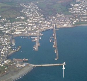
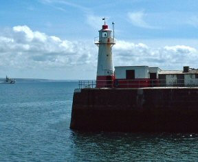
NEWLYN
Station summary


Links to data sources

Co-located instrumentsNEWLY
- GPS : Newlyn (NEWL)
- GPS : Newlyn Tide Gauge GNSS (JPNL)
Leveling & DatumsNEWLY
Photo albumNEWLY
BibliographyNEWLY
If you have a relevant reference to suggest, please send-us an e-mail : sonel@sonel.org-
 Araujo, Pugh, 2008. Sea Levels at Newlyn 1915–2005: Analysis of Trends for Future Flooding Risks. Journal of Coastal Research.

-
Bradshaw, Woodworth et al., 2015. A Century of Sea Level Measurements at Newlyn, Southwest England.

-
Woodworth, Hibbert, 2015. Sea-level monitoring in the British verseas Territories. Journal of Operational Oceanography.


