DAKAR

Station summary

Showing all stations within 1000 km of the observed station Active station No data for 30 days Decommissioned No observations in SONEL (Survey) Not co-located with observed station
Showing all stations within 1000 km of the observed station Available data / Station OK Available data / Problem(s) detected Does not work No longer exists Foreign partner management Not co-located with observed station
Showing all stations within 1000 km of the observed station Co-located with observed station Not co-located with observed station
  • More informations on each symbol.
  • GPS
    Tide Gauge
    DORIS
Responsible organization: Service Hydrographique et Océanographique de la Marine
Latitude : 14.67775400
Longitude : -17.43078800
Country: SENEGAL
City: DAKAR
Station state: Foreign partner

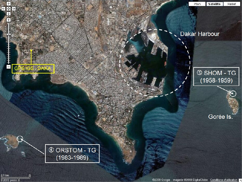
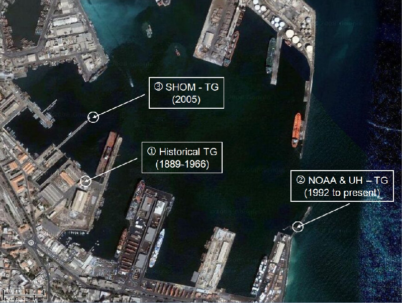
Co-located instrumentsDAKA2

Photo albumDAKA2

BibliographyDAKA2

If you have a relevant reference to suggest, please send-us an e-mail : sonel@sonel.org
  • puce Le Cozannet, Raucoules et al., 2015. Vertical ground motion and historical sea-level records in Dakar(Senegal). Environmental Research Letters. Get this reference
  • puce Woodworth, Aman et al., 2007. Sea level monitoring in Africa. African Journal of Marine Science. Get this reference