
VENEZIA
Contributing agency

Station summaryVEN1


| IGS-type acronym : | VEN100ITA |
| Latitude : | 45.43056944 |
| Longitude : | 12.35407778 |
| Installed date : | 2008-08-01 |
| Decommissioned date : | |
| Country : | ITALY |
| City: | VENEZIA |
| Station status : | active (green) |
| Distance to Tide Gauge (m) : | 1384 |
| Domes Nr.: | 19513M001 |
| Station operator: | Unknown |
| IGS-like station form : |
GPS position times seriesVEN1
(Reference epoch: )
| M | Material change or malfunction |
| E | Earthquake |
| RF | Reference Frame change |
| U | Unknown |
| NA | Not available |
| Position discontinuity | |
| Velocity discontinuity |
Data available at SONELVEN1
Quality plots on RINEX filesVEN1
 |
 |
Plots generated using software developed with the EPN team at ROB |
| Observations & tracking performance | Satellite tracking |
 (this operation may take 20 to 45s)
The satellite tracking graph has been calculated for all stations for the first day of each month. If you wish to have a graph for another date, choose the 'Calculate a specific date' option.
Co-located instrumentsVEN1
- GPS : Venezia (VENE)
- Tide gauge : VENEZIA II (VENTG)
- Tide gauge : VENEZIA (PUNTA DELLA SALUTE) (PDSTG)
- Tide gauge : VENEZIA (S.STEFANO) (VENSS)
- Tide gauge : VENEZIA (ARSENALE) (VENAR)
- GPS : VENEZIA - Arsenale (VEAR)
- GPS : Venezia Nicelli (VENI)
- GPS : Venezia Punta Salute (PSAL)
- Tide gauge : LIDO DIGA SUD (LDSTG)
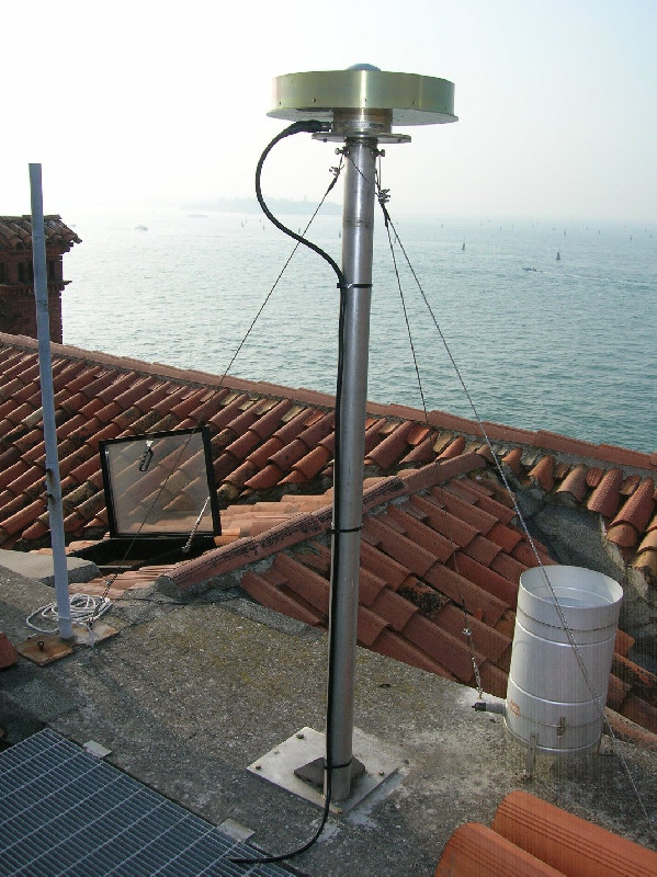
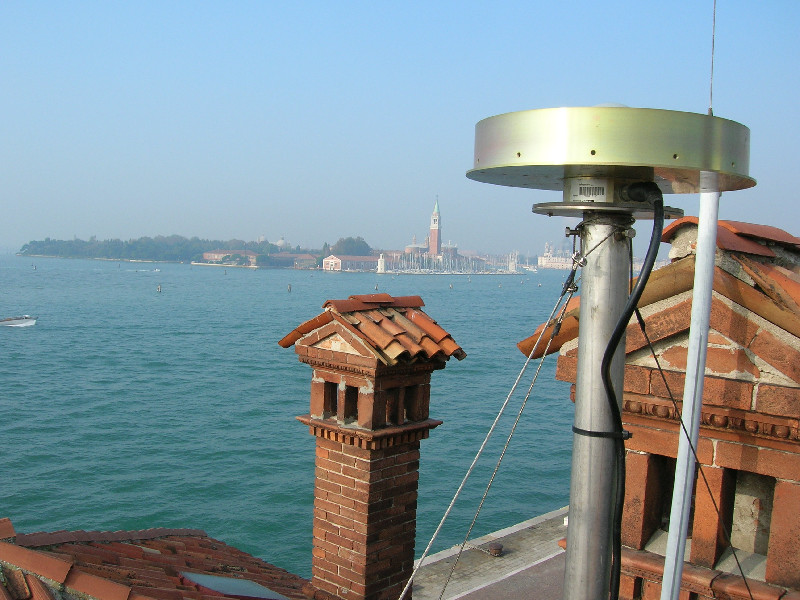
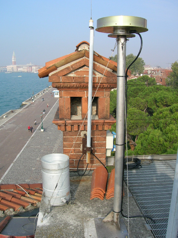
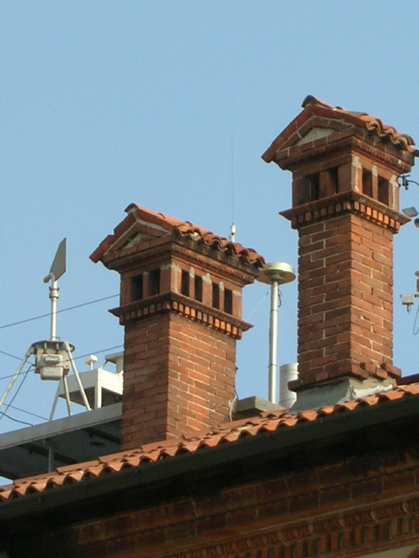
Photo albumVEN1
BibliographyVEN1
If you have a relevant reference to suggest, please send-us an e-mail : sonel@sonel.org-
 , Zerbini et al., 2006. Tide gauges and Geodesy: a secular synergy illustrated by three present-day case studies. C. R. Geoscience.

-
, Carbognin et al., 2002. Evidence of the present relative land stability of Venice, Italy, from land, sea, and space observations. Geophysical Research Letters.
-
De-Biasio, Baldin et al., 2020. Revisiting Vertical Land Motion and Sea Level Trends in the Northeastern Adriatic Sea Using Satellite Altimetry and Tide Gauge Data. Journal of Marine Science and Engineering.

-
Pajak, Kowalczyk et al., 2021. Studying the Sensitivity of Satellite Altimetry, Tide Gauge and GNSS Observations to Changes in Vertical Displacements. Geomatics and Environmental Engineering.
-
Strozzi, Teatini, 2009. TerraSAR-X reveals the impact of the mobile barrier works on Venice
coastland stability. Remote Sensing of Environment.
-
Vignudelli, De-Biasio, 2021. Coastal Sea Level Trends from a Joint Use of Satellite Radar Altimetry, GPS and Tide Gauges: Case Study of the Northern Adriatic Sea. Geodetic Sciences - Theory, Applications and Recent Developments.
-
Woppelmann, Marcos, 2012. Coastal sea level rise in southern Europe and the nonclimate contribution of vertical land motion. Journal of Geophysical Research.
-
Zerbini, Raicich et al., 2017. Sea-level change in the Northern Mediterranean Sea from long-period tide gauge time series. Earth-Science Reviews.
Log bookVEN1
[EUREFmail-9497] - 2018-07-26 (30/07/2018)
On DOY 2018/207, VEN1 (Matera, Italy) Leica GR30 firmware was updated
from 4.11/7.102 to 4.20/7.300.
Updated sitelog was submitted to EUREF.
[EUREFmail-9360] - 2018-04-10 (10/04/2018)
Please be adviced that, due to a power supply failure, data from VEN1
(Venezia, Italy) from doy-hour 097-J up to 100-G are lost.
[EUREFmail-9318] - 2018-03-08 (14/03/2018)
Please be adviced that on DOY 2018/067, at VEN1 (Venezia, Italy) station
the old Leica 1200GGPRO receiver was replaced by Leica GR30 with LEIAR20
antenna. The new station is able to record GALILEO and BEIDOU data and
will produce Rinex 3.03 also.
Updated sitelog has been submitted to EUREF.


