
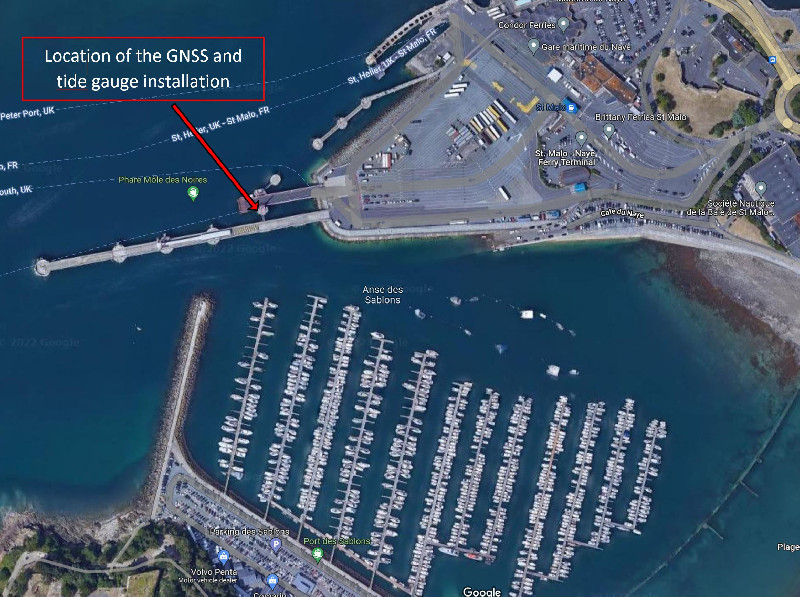
SAINT-MALO
Contributing agency


Station summarySMTG


| IGS-type acronym : | SMTG00FRA |
| Latitude : | 48.64110800 |
| Longitude : | -2.02747700 |
| Installed date : | 2010-02-17 |
| Decommissioned date : | |
| Country : | FRANCE |
| City: | SAINT-MALO |
| Station status : | active (green) |
| Distance to Tide Gauge (m) : | 2 |
| Domes Nr.: | 19936M001 |
| Station operator: | (RENAG) - Réseau National GPS permanent (LIENSs-OASU) - LIENSs - OASU |
| IGS-like station form : |
GPS position times seriesSMTG
(Reference epoch: )
| M | Material change or malfunction |
| E | Earthquake |
| RF | Reference Frame change |
| U | Unknown |
| NA | Not available |
| Position discontinuity | |
| Velocity discontinuity |
Data available at SONELSMTG
Quality plots on RINEX filesSMTG
 |
 |
Plots generated using software developed with the EPN team at ROB |
| Observations & tracking performance | Satellite tracking |
 (this operation may take 20 to 45s)
The satellite tracking graph has been calculated for all stations for the first day of each month. If you wish to have a graph for another date, choose the 'Calculate a specific date' option.
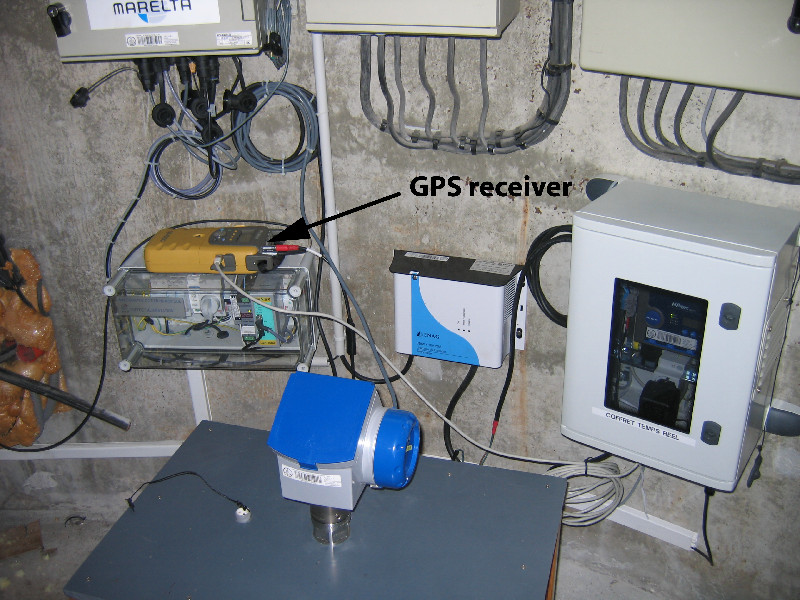
Co-located instrumentsSMTG
- Tide gauge : SAINT-MALO (SMALO)
- GPS : Dinard Pleurtuit (DIPL)
- Tide gauge : Saint Servan (SSERV)
Leveling & DatumsSMTG
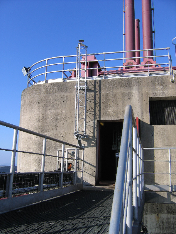
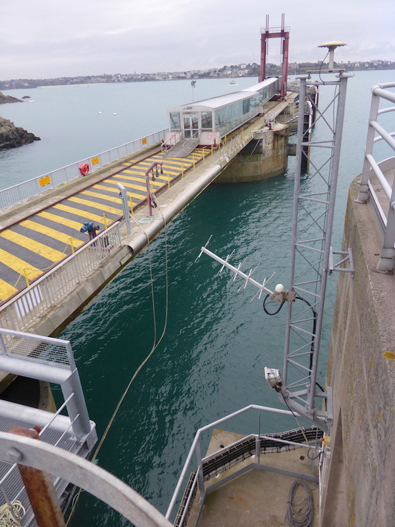
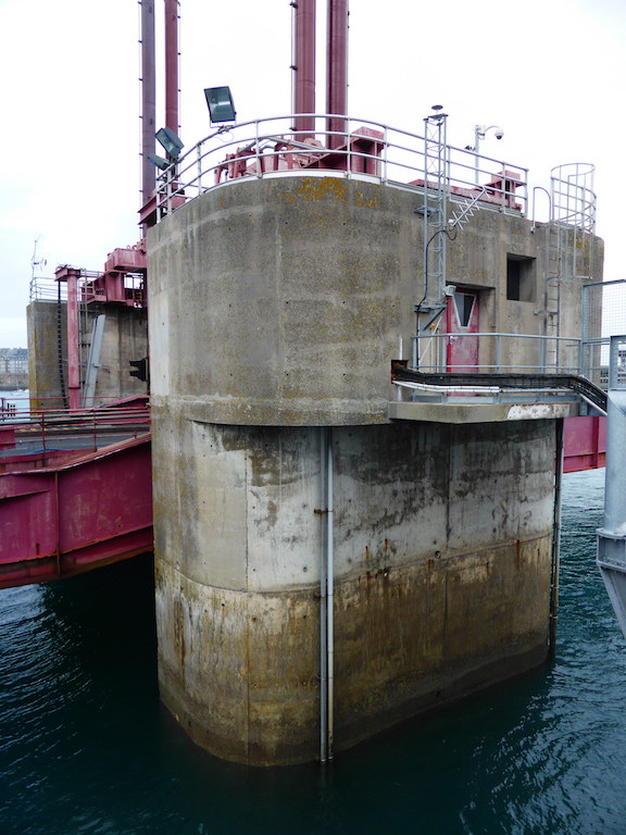
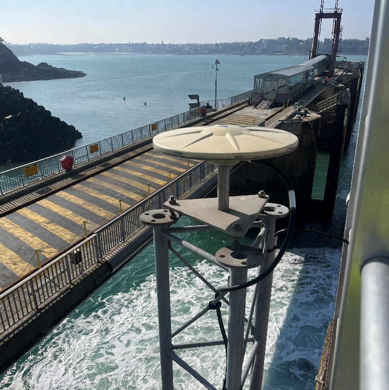
Photo albumSMTG
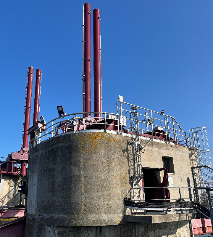
![GPS antenna [Topcon TPSGP_A1+GP]](squelettes/mareg/index.php?a=gsi&img=IMG_5043_1936.JPG)
| Titre du document | Vignette |
|---|---|
| GNSS Antenna - 3m steel mast - Yagi antenna -Nov 2016 |

(243 Ko) |
| Concrete block at the ferry terminal. |

(221 Ko) |
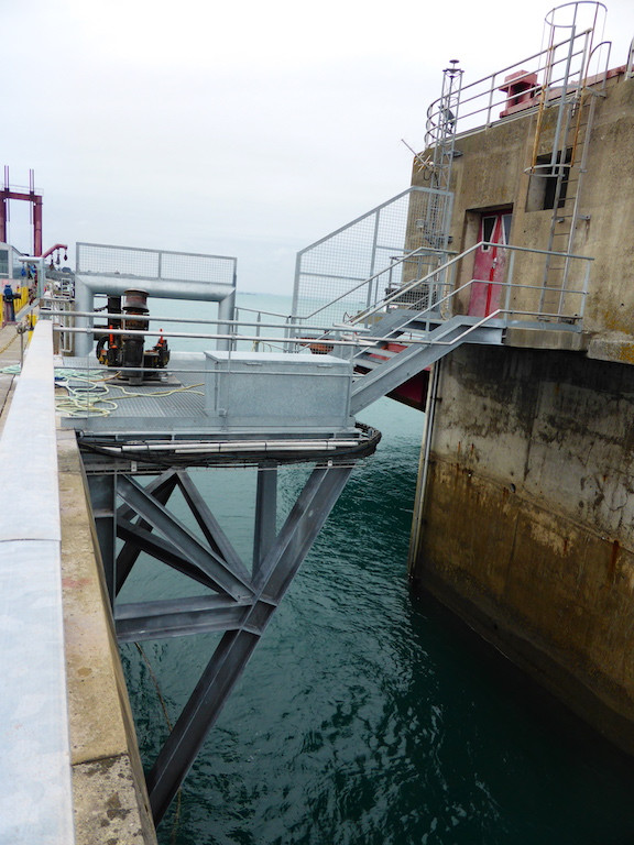
| New gangway installed in October-November 2016 to access the site |

(214 Ko) |
| Brass nail DOMES 19936M001 |

(306 Ko) |
BibliographySMTG
If you have a relevant reference to suggest, please send-us an e-mail : sonel@sonel.org-
 Breilh, 2010. Installation d'une station GPS permanente (SMTG) au marégraphe de Saint-Malo.

-
Coulomb, 2014. Travaux réalisés en métropole en 2013 dans le cadre de la convention SONEL.
-
Dodet, Bertin et al., 2019. Characterization of Sea-level Variations Along the Metropolitan Coasts of France: Waves, Tides, Storm Surges and Long-term Changes.

-
JEANNE Sarah, 2025. Compte-rendu de mission de changement d'antenne et de reconnaissance du site.
History of the stationSMTG
The main rationale for installing a GPS station at Saint-Malo is the historical tide gauge record of Saint-Servan, 800 m apart from the new Saint-Malo tide gauge station (see pictures at the tide gauge webpage, link below). The early values of Saint-Servan date back to 1850, and sea level was continuously recorded for more than 50 years with respect to the same hydrographic datum. After 1917, the record is discontinuous, but there are hints that observations may exist in paper form over the entire 20th century. A data archeology exercise would help to investigate this issue, and hopefully rescue the valuable data.
Log bookSMTG
2021-09-16 (23/05/2022)
Intervention by the SHOM to change the acquisition central of the tide gauge. Before it was an Elta system, now it is a Campbell. Also, installation of the meteorological sensor and the camera
2020-01-30 (28/07/2020)
SMTG GNSS receiver has been replaced. TopCon GB100 has been successfully replaced by a Septentrio Polarx5.
E.Poirier
[RGPmail] - 2020-02-03 (04/02/2020)
Les données des stations ROTG (29, Finistère) SMTG (35, Ille-et-Vilaine) TLTG (83, Var) sont de nouveau disponibles depuis les sessions 029r, 030r et 029a respectivement.
Les données manquantes ne pourront pas être récupérées.
2019-12-06 (06/12/2019)
Depuis plusieurs mois, il y a des dysfonctionnements dans les jours de données GNSS disponibles à la station SMTG. Un reboot a été fait aujourd'hui par Jean Desrois à Saint-Malo vers 13:30 UTC le 6 décembre 2019.E.Poirier.
2019-08-21 (21/08/2019)
Panne de la station du jour 225 (13 août) au jour 230 (18 août) inclus. Cause inconnues mais panne simultanée à ROTG, matériel identique.
2019-05-16 (16/05/2019)
Quelques données brutes 1h/1sec *.tps de SMTG ont été sauvées et uploadees sur sonelprod de la session 412n (12 avril 2019) à la session 415d (15 avril 2019) mais ces journées sont incomplètes.
L'installation est revenue en fonctionnement normal le 24 avril à la session 424o (14:00-15:00 UTC).
Les données sont perdues définitivement du jour 097 session a (7 avril 2019 00:00 UTC) au jour 102 session m (12 avril 2019) et aussi du 15 avril au 24 avril session 424n. Soit près de 16 jours perdus. E. Poirier
2019-03-06 (16/05/2019)
Les données brutes 1h/1s de ROTG et SMTG sont a présent envoyées directement vers le RGP qui se charge de Rinexer. Nous ne produisons plus de Rinex à SONEL. Nous allons chercher les fichiers jour/30s sur le site du RGP directement. E.Poirier
2019-04-24 (16/05/2019)
Mission sur place: Mise à jour du firmware de GB1000 car le récepteur est en panne depuis le 6 avril. La version 3.5p5 remplace la 3.3p6 (Main 3.02U).
Problème pour télécharger les données du GB1000. Des pertes irrémédiables sont à prévoir. Reconfiguration de l'enregistrement par GRIL. E.Poirier
2019-04-06 (16/05/2019)
La station GNSS SMTG est tombée en panne au moment du GPSweek rollover. Le firmware 3.3p6 de la carte EGGT est trop vieux. Il faut installer un firmware 3.5p5. La station est déclarée en panne par le RGP. E.Poirier.
2012-01-19 (16/05/2019)
2012-01-19 : Due to a power failure DOY 12 and 17 are imcomplete. DOY 13 to 16 are permanently lost.
[RGPmail] - 2016-12-06 (06/12/2016)
Due to the important move of the position of the SMTG station (France), the dataflow is interrupted for this station. Works are in progress to solve the problem, but none kows the delay to recover a normal dataflow.
23/11/2016: Inspection of the GNSS station (25/11/2016)
RGP recently noticed a drift on the position of SMTG. Etienne Poirier went there on the 23th of November to investigate. Together with Jean Desrois (Harbour agent), we noticed that the SMTG 3m mast is OK and nothing moved. Therefore it is assumed that the drift comes from a displacement of the concrete block where the station seats. This displacement is a harbour authorities well known problem caused by the sediment scouring under the concret block. This is due to the ferry propellers washing the sediments out. This problem may be solved by the harbour of St-Malo using divers and underwater concrete.
26/03/2010: Installation of the GPS station (29/03/2010)
Monumentation and antenna were installed mid-February 2010. The receiver started recording on 17/02/2010. RINEX files are downloaded daily thanks to the ADSL line provided by SHOM, shared with the tide gauge.


